Valley gorges, glaciers crisscross, and thousands of massive peaks point straight to the sky!
Some say trekking is a baptism of life and a devotion to one’s life beliefs.
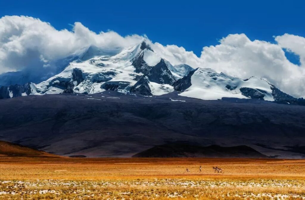
Only after traversing the polar regions can one truly understand cold and heat. Only after climbing snow-capped mountains can one appreciate their magnificence. Walking among countless mountains, one feels a dialogue with oneself and a resonance between the soul and the mountains. One experiences the vastness and grandeur of great deserts, glaciers, canyons, and sword-like peaks!
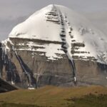
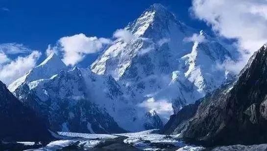
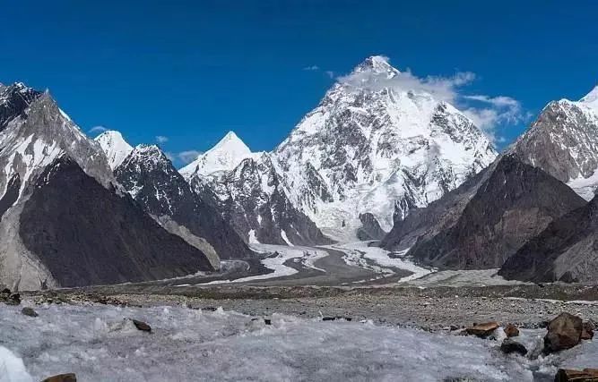
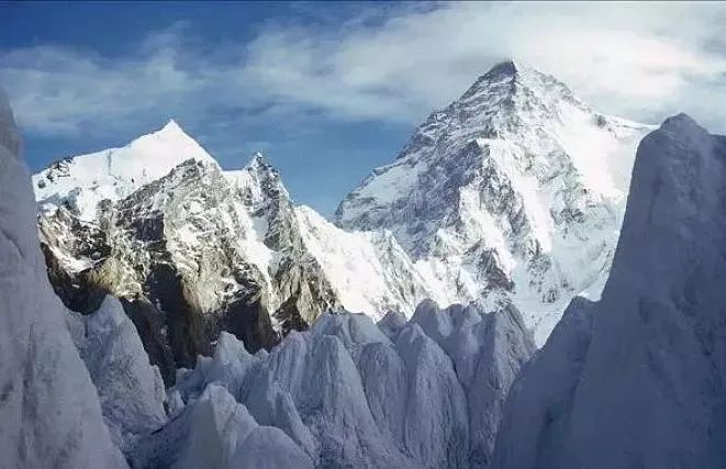
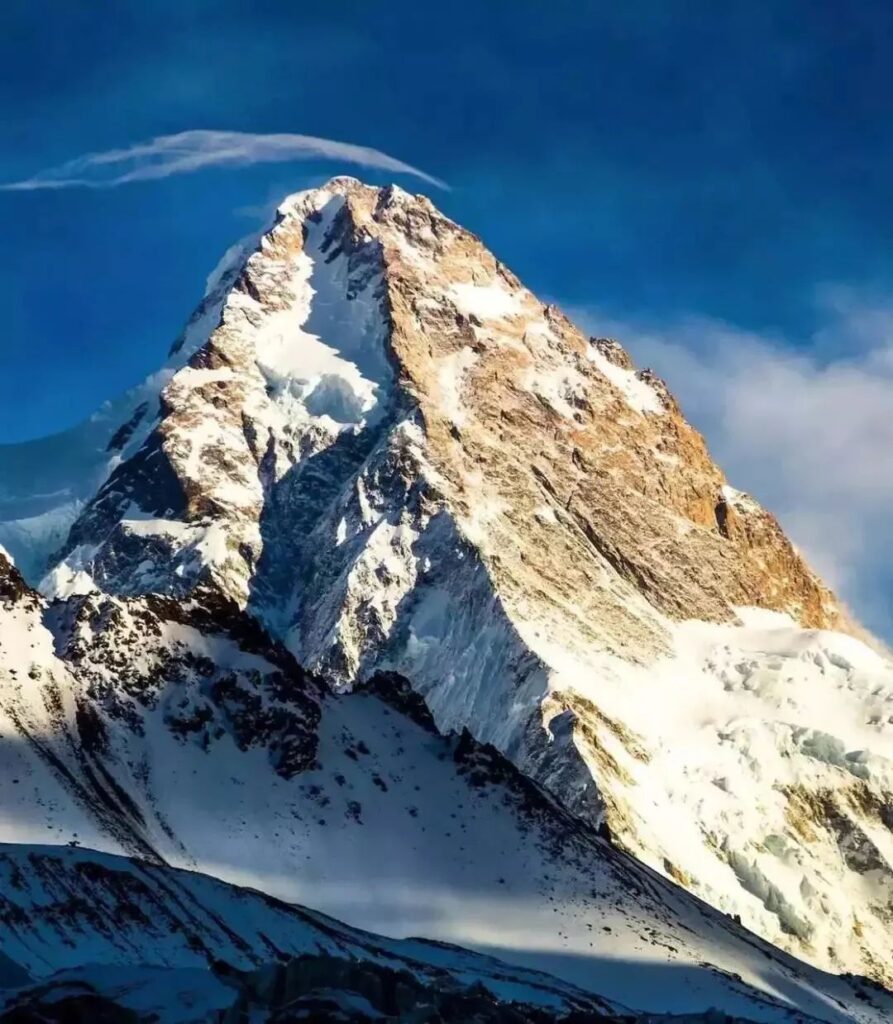
K2 is the white pyramid straddling the China-Pakistan border, standing proudly under the heavens. Its snow-white peak has always been at the ultimate pinnacle of human aspiration. It’s the world’s second-highest mountain, with an elevation second only to Mount Everest. However, in terms of climbing difficulty and mortality rate, it can be considered the most challenging!
This is K2, with an elevation of 8,611 meters, a mountain that allows you to challenge human limits and glimpse heaven.
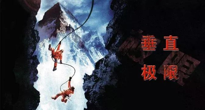
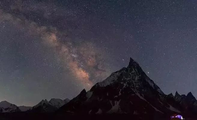
In 2000, an adventure film called “Vertical Limit” swept the globe. Hollywood’s sophisticated filmmaking techniques brought a thrilling ice peak rescue story to life. The backdrop for this story was the world-renowned K2.
The Chinese side of K2 is located in Yecheng County, Xinjiang. This is an important town in southern Xinjiang. Driving along the Xinjiang-Tibet Highway to Mazar, then following a simple road for 25 kilometers to Mazadala, and finally trekking 90 kilometers, one can reach the K2 base camp. Despite such difficulties, explorers and climbing teams continue to flock here. Many climbers bring professional climbing equipment and tents, hiring local horsemen to take them to the foot of the mountain.
As a crucial pass on the east-west transportation route, more people than you might imagine want to conquer this mountain with an average elevation above 6,000 meters. Historical figures like Faxian, Xuanzang, and Marco Polo have all gazed upon its towering presence and marveled at its grandeur.
It wasn’t until 1954 that K2 was conquered by two members of an Italian climbing team (Lino Lacedelli and Achille Compagnoni). They ascended via the southeast ridge on the Pakistani side. The north face on the Chinese side wasn’t conquered until after 1982 by a Japanese Alpine Club expedition.
In 2004, seven brave members of the Chinese Tibet Mountaineering Team successfully reached the summit of K2. This was the first Chinese ascent of the world’s second-highest peak, located on the China-Pakistan border in the Karakoram range.
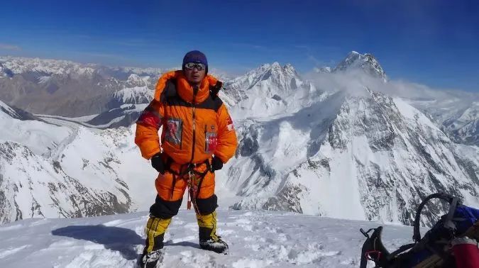
On July 30, 2012, Yang Chunfeng and his teammates Zhang Jingchuan and Rao Jianfeng successfully summited via the south face. This was the first successful ascent by a Chinese civilian climbing team.
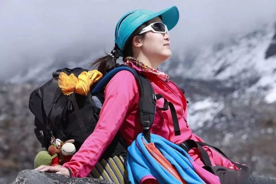
On July 26, 2014, at 2:15 PM, 39-year-old Luo Jing successfully summited K2, becoming the first Chinese woman to do so. Reportedly, 19 people summited K2 at the same time as Luo Jing, including six women: three Nepalese, one Italian (without oxygen), and one Australian.
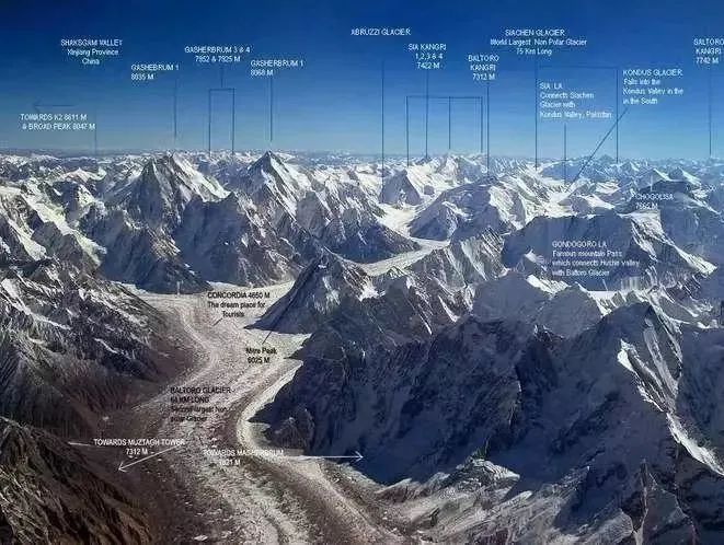
Although the glaciers on the southern side are impressive, the northern glaciers within Chinese territory far outnumber those on the south face. To climb K2 from the north face, one must traverse the Skyang Glacier, K2 Glacier, Rongbuk Glacier, and Yinsugaiti Glacier. These four glaciers are small compared to other Karakoram glaciers, but they shouldn’t be underestimated. The Yinsugaiti Glacier, for instance, covers an area of 329 square kilometers, far exceeding the area of Mediterranean island nation Malta and the Indian Ocean island nation of Maldives.
Although K2 is the world’s second-highest peak, it far surpasses Mount Everest, the highest, in terms of climbing difficulty and mortality rate. The death rate for climbers is a staggering 1:7, earning it the ominous nickname “Savage Mountain.”
Internationally, K2 is the more common name for this peak. The “K” stands for Karakoram, the mountain range’s English name, while “2” indicates it was the second peak in the range to be surveyed by humans. Due to its treacherous terrain and harsh climate, anyone who ventures to explore this savage mountain can be considered heroic. In such a remote and desolate location, visitors must be entirely self-sufficient for food, shelter, and other necessities. Along the lengthy approach, the climate changes dramatically with altitude, making ample clothing and medical supplies essential.
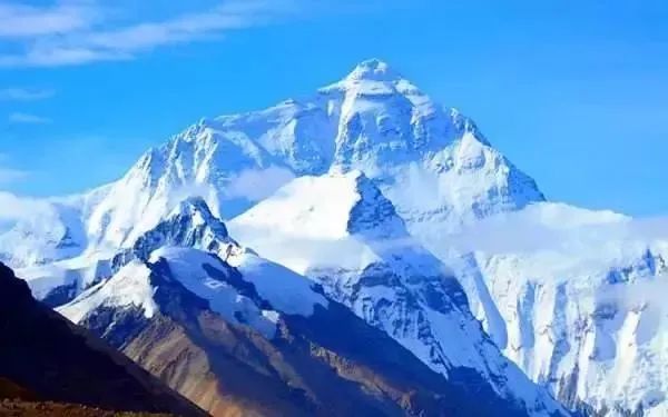
While Everest is over 240 meters taller than K2, the technical challenges K2 presents to climbers are no less daunting. As technology advances, summiting Everest has become increasingly safe, but K2 remains a symbol of nature’s ultimate test of human will and ability.
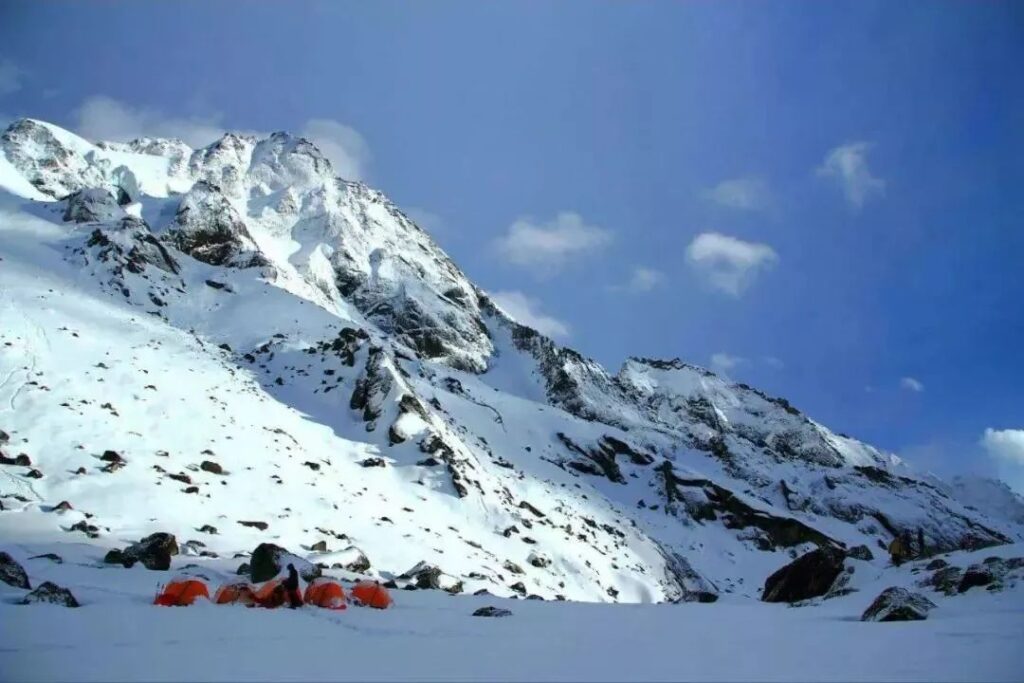
The approach to K2 is currently the longest of any open mountain in China. From Yecheng, a major town in southern Xinjiang, one travels by car along the Xinjiang-Tibet Highway to Mazar, then another 25 kilometers on a rough road to Mazadala. From there, it’s a six-day trek to reach Yinhong Tan at 3,924 meters, which serves as the base camp for K2 expeditions.
The 90-kilometer approach requires crossing the 4,800-meter Aghil Pass to enter the Shaksgam River valley. Many climbers avoid July and August when the river is at its highest, making it impassable even for the most agile horses.
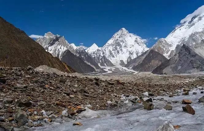
The towering snow-capped peak instills a sense of pilgrimage, while the sprawling glaciers below keep climbers on constant alert. The Yinsugaiti Glacier, China’s largest at 30 kilometers long, feeds the Yarkand River when it melts. Gazing at this glacier from base camp is a rite of passage for climbers. The massive ice field and its dozen tributary glaciers form a tree-like pattern in the valley, with countless ice towers glittering in the sunlight.
The journey to K2 offers vast vistas but is eerily silent. Camel caravans appear tiny beneath the towering peaks on either side. Sometimes, fierce winds whip up sand from riverbeds, forcing trekkers to bow their heads as they march on. At other times, dense fog shrouds everything, concealing K2 behind mystical clouds. The trek also offers unexpected delights, such as encounters with the graceful golden Tibetan wild ass. These beautiful creatures quietly observe passing climbers from the roadside, as if they were K2’s welcoming committee.
As you approach K2, the folded geological landscapes and fissure springs of the Shaksgam River offer unique sights not found elsewhere. While Xinjiang has many folded geological features, none compare to those here. The black metamorphic rock layers, nearly 100 meters high and 1,000 meters long, form various extraordinary shapes, encompassing all phenomena resulting from tectonic forces. This exemplifies the typical characteristics of the Himalayan orogeny, which explains why geologists, in addition to adventurers and photographers, are particularly drawn to K2.
Near the K2 Broad Peak camp, you’ll hear the sound of rushing water from the K2 fissure spring. The spring’s flow is so substantial that it can be heard from hundreds of meters away. The area where the water flows is covered with tamarisk and forms a 1,000-meter-wide marsh. The spring seeps out from rock layers in the steep valley walls, creating a waterfall 20 meters wide and 5 meters high due to the elevation difference. Through the waterfall, you can see many red granular rocks accompanying the black rock face, resembling the “Water Curtain Cave” of the Kunlun Mountains and forming a major attraction of the Shaksgam River.
The best location to photograph K2 is from the platform on the right side of the K2 Glacier. From here, you can see the glacier in the deep valley, the black glacial debris covering it, and K2 itself, bathed in the red glow of the setting sun.
With your camera on your back, descend the steep slope to the valley floor, using an ice axe to create footholds and supporting yourself against the slope face. As you navigate the boulder-strewn slope, you’ll notice many rocks tied with yellow ribbons, placed by mountaineers as route markers. For those accustomed to lower altitudes, walking on these boulders at 4,500 meters can leave you breathless and struggling after just two hours, with a parched throat. The crevices between rocks often contain pure snow, resembling white sugar. Climbers sometimes eat it to quench their thirst, but this can actually increase thirst, so experienced guides often discourage this practice.
After crossing a ridge, you can reach the forefront of the K2 Glacier. Find a large boulder on the slope to use as a foothold and shooting spot. Facing the towering K2, you’ll feel that any effort was worthwhile. From around 4 PM until after 9 PM, you can capture some of the most beautiful photographs of your life, with every shutter release being invaluable.
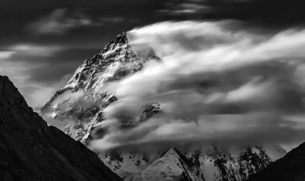
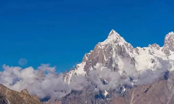
The eternal snows of the Karakoram Range glisten in the sunlight, surrounding K2’s majestic form as it pierces through the clouds, standing proud between heaven and earth. For the brave, K2 is a sacred place full of endless allure, and the ultimate peak for facing one’s limits. If mountains had gender, K2 would undoubtedly be the most masculine, maintaining its mystery and dignity through unparalleled steepness and bizarre climate.
In early 2018, K2 was officially certified by Guinness World Records as the “mountain with the longest trekking route to its base camp.”