When discussing Mount Gongga, one cannot overlook the Hailuogou Glacier.
Mount Gongga has developed a total of 76 modern glaciers, with five exceeding 10 kilometers in length. All of these are concentrated around the main peak. Due to the influence of moisture from the east, four large glaciers have developed on the eastern slope.
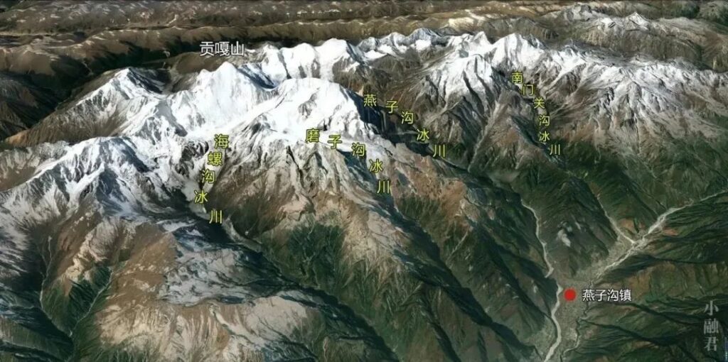
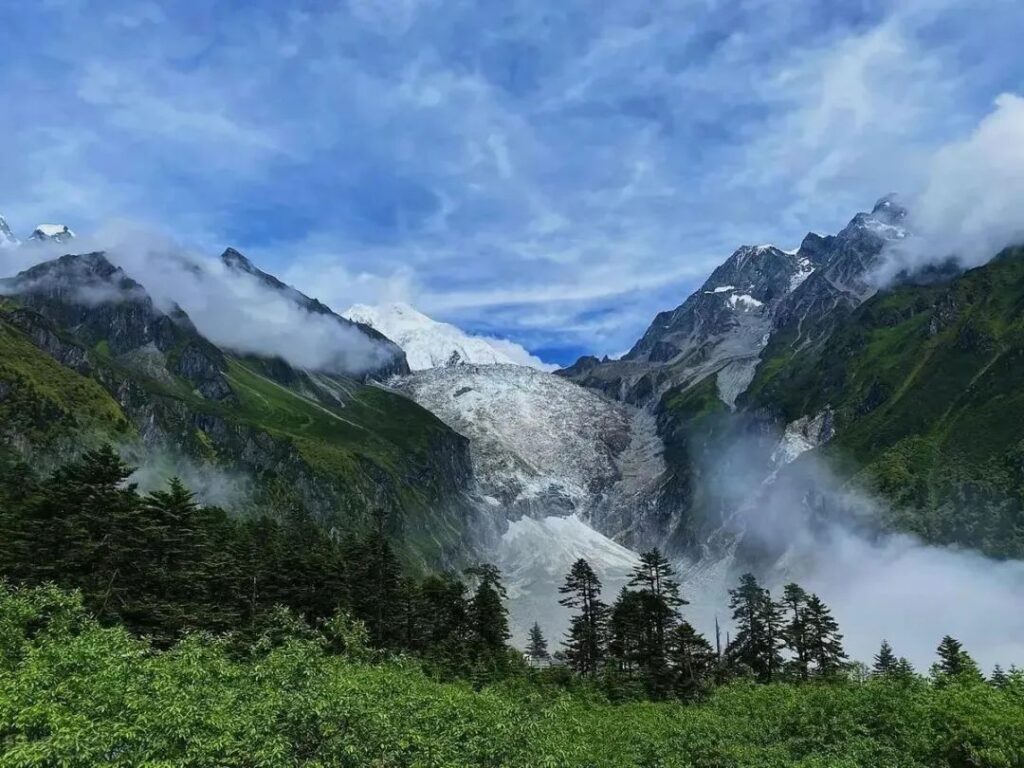
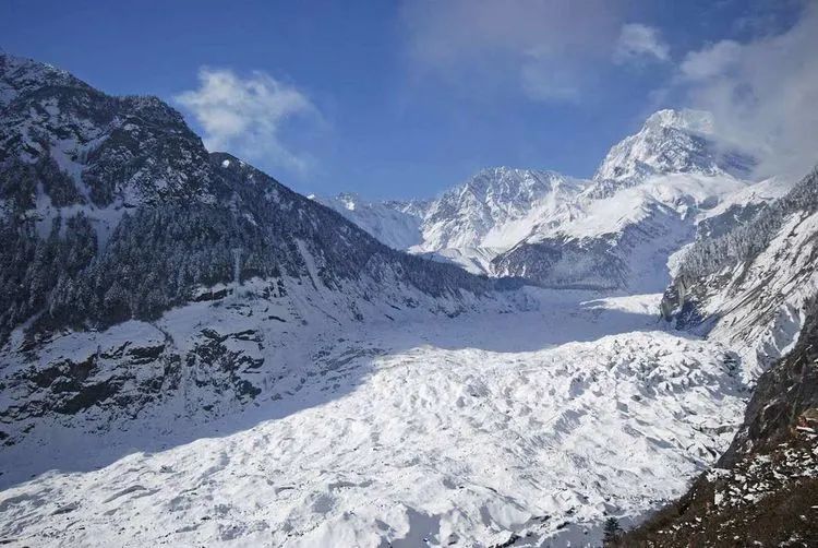
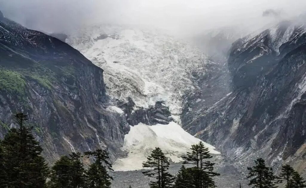
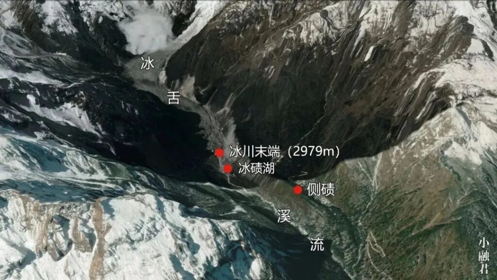
As glaciers descend along the valley, Hailuogou Glacier has made remarkable progress, advancing far ahead of others. It reaches down to an altitude of 2,979 meters in the forest zone, creating a unique spectacle where glacier and forest coexist.
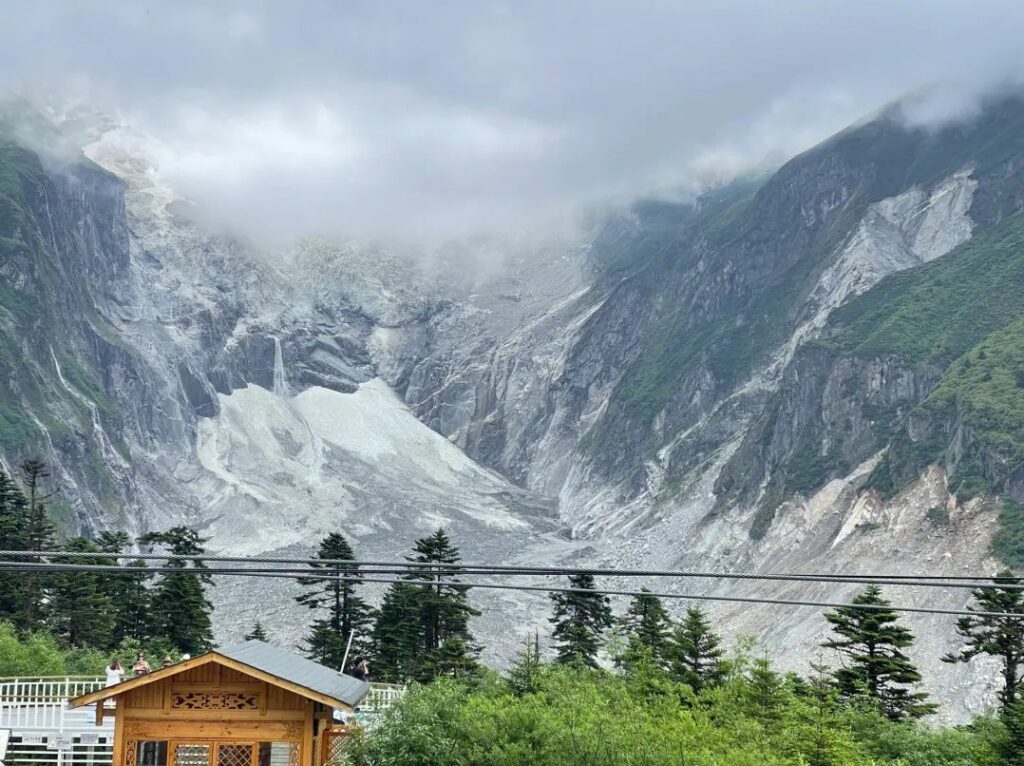
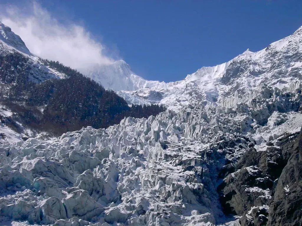
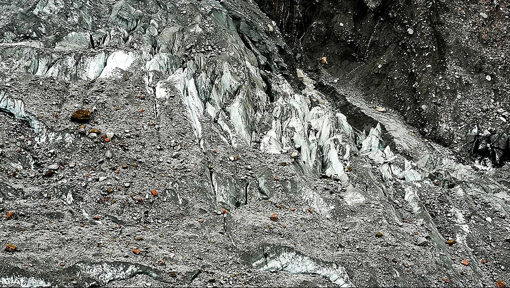
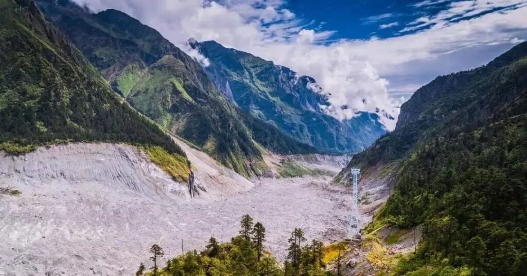
People flock to admire this glacial wonder… but wait, why does the glacier look so grimy? Could it be a mudslide in disguise? The glacier is interspersed with gravel and rock debris of various sizes, with some boulders standing over 10 meters tall. The entire valley resembles a construction site filled with cement.
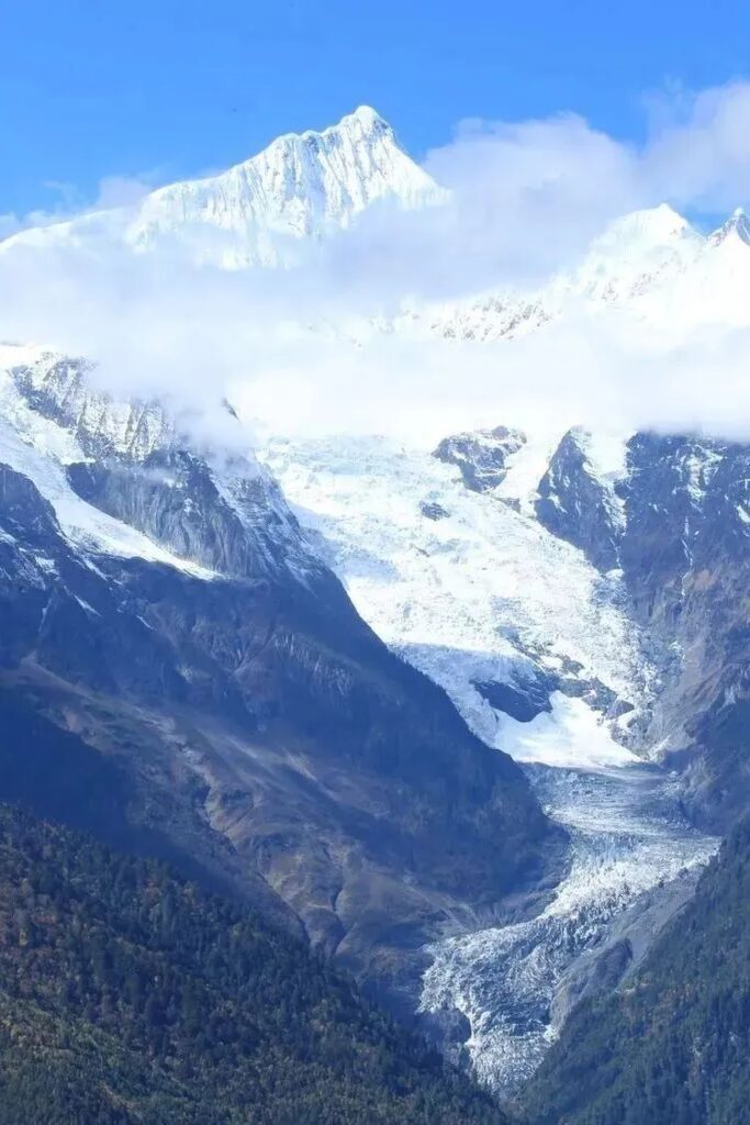
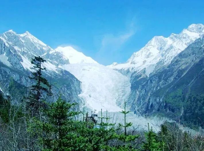
Looking at the Mingyong Glacier in Deqin, Yunnan, we see a similar story. This glacier descends to an altitude of 2,700 meters, surpassing the Hailuogou Glacier and claiming the title of “lowest altitude glacier in the Hengduan Mountains region.”
Is this darkened appearance a common characteristic of Hengduan Mountain glaciers?
Before rushing to judgment, let’s shift our gaze to the mountaintop and observe the glacier’s journey downward. You’ll soon understand its “arduous path.”
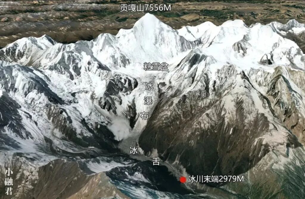
The Hailuogou Glacier’s development can be divided into three stages.
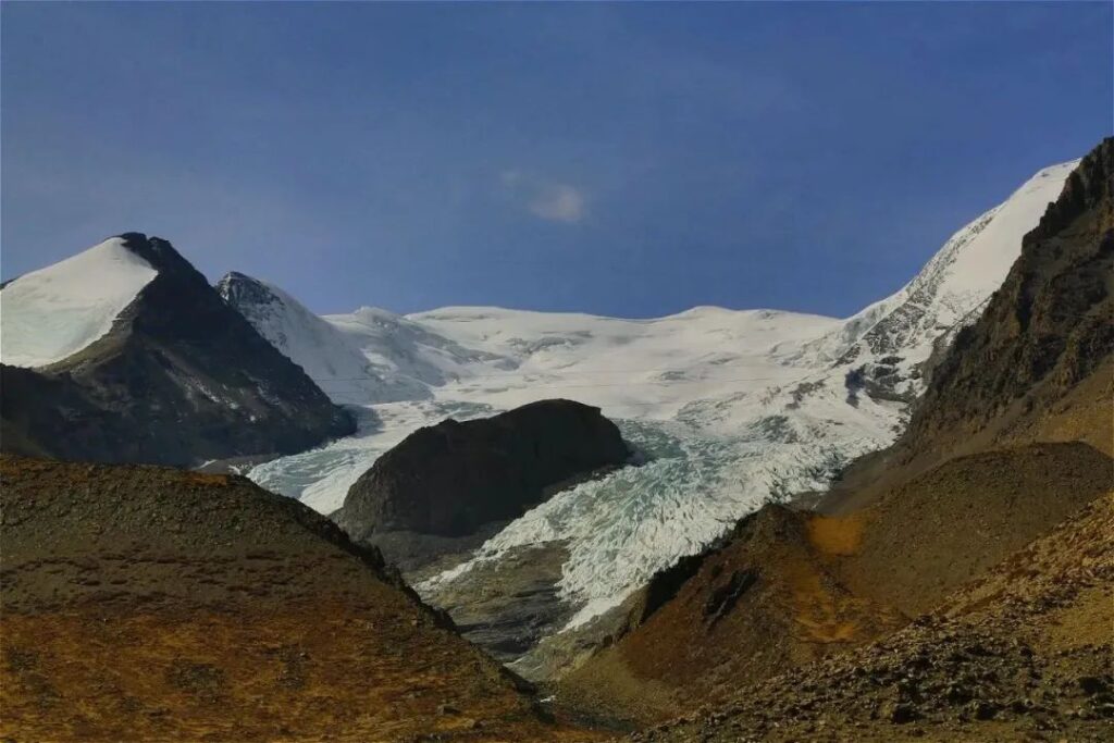
First is the “gestation period” in the firn basin, located between 6,750 and 4,800 meters above sea level. This basin, an area above the snowline where snow and ice accumulate, is perhaps the most easily understood term in geographical jargon. Measuring about 3.2 kilometers long and 3.5 kilometers wide, it serves as a massive glacier production base.
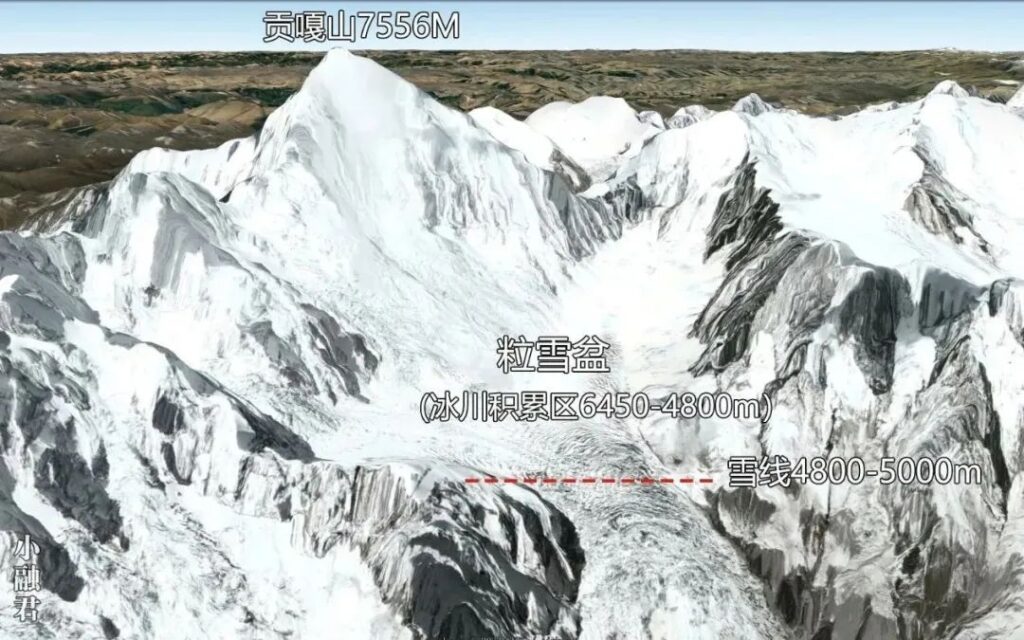

The firn basin is backed by the main peak, faces the valley, and is surrounded by mountains on three sides, firmly occupying the lowest terrain.
It seems like a perfect spot with a broad view and excellent feng shui…
But wait, what’s that sound?
Suddenly, a thunderous noise echoes from above. A large mass of ice and snow collapses from the surrounding cliffs, tumbling into the firn basin. Rock fragments from the mountain face fall alongside the snow and ice. In an instant, the mountain seems to split open, enveloped in a cloud of snow and mist.
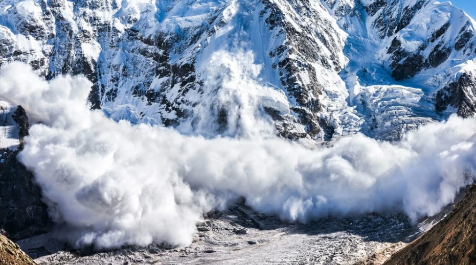
The main peak of Gongga towers 1,100 meters above the firn basin. While the basin thought it had found a stable “backing,” it turns out this “support” is emotionally unstable and prone to destructive outbursts. Due to the steep gradient of the basin’s rear wall, avalanches occur daily. Ice, snow, and rocks tumble down the cliff face, depositing raw materials into the “glacier production base” – the firn basin.
Meanwhile, the southeast monsoon brings abundant snowfall. As a result, ice and snow accumulate thicker in the firn basin. The ice and snow compressed at the bottom layers undergo a qualitative change due to years of pressure, transforming into “glacier ice.”
The formation of a glacier can be seen as a perfect history of struggle against compression.
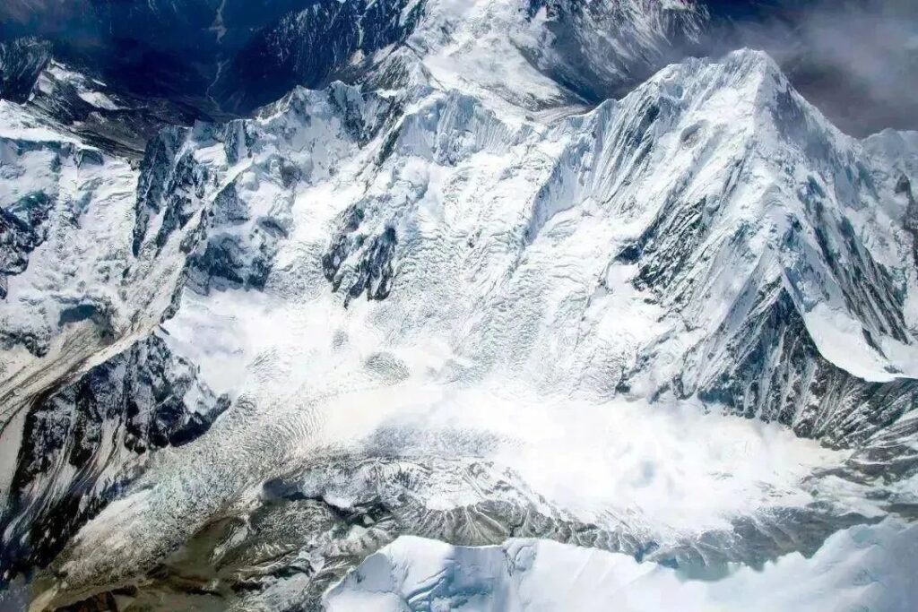
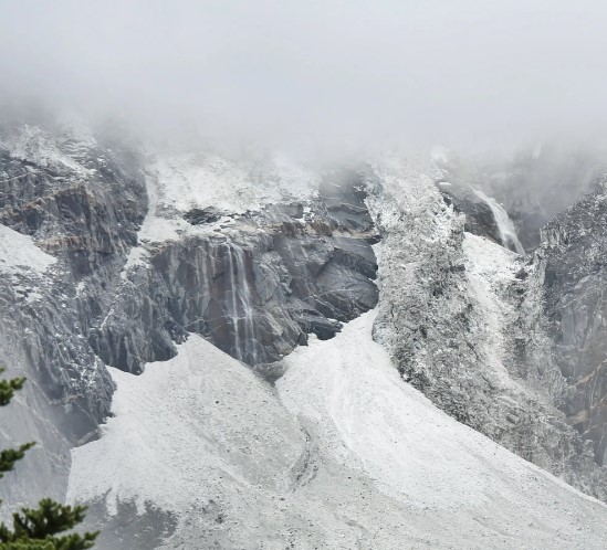
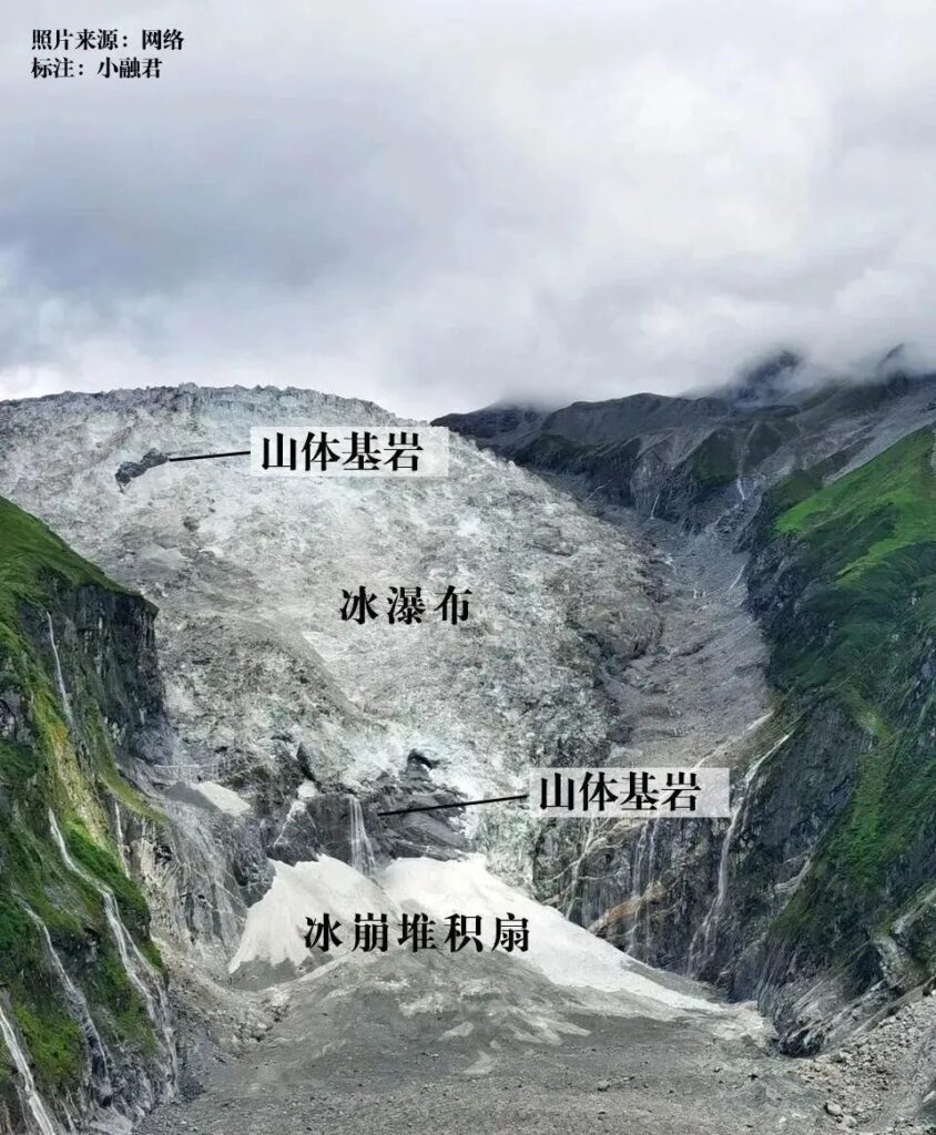
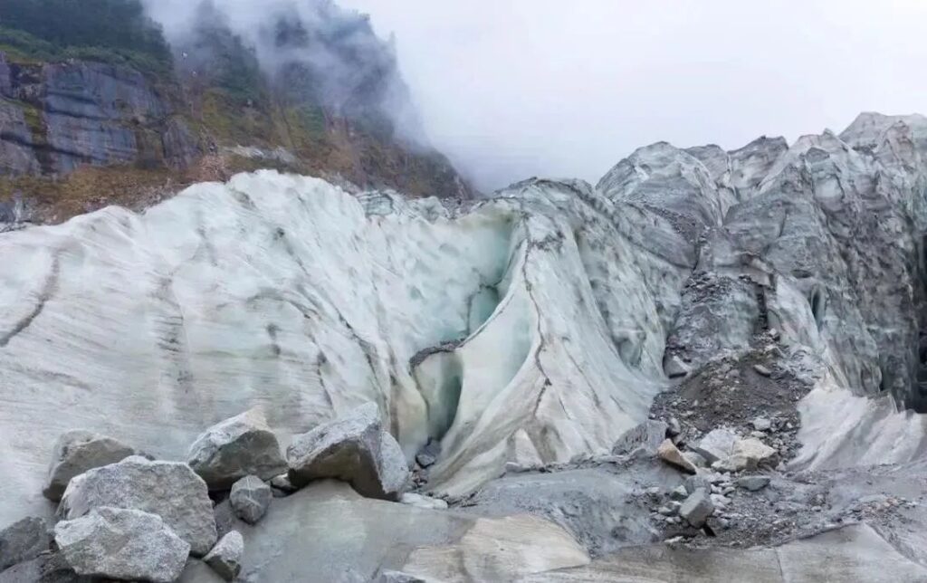
Once the glacier leaves the firn basin, it encounters a massive icefall with a vertical drop of 1,050 meters. Here, the glaciers indulge in an exhilarating descent, moving at an astonishing speed of 500 meters per year! In contrast, most glaciers in the western regions only move 30-50 meters annually.
A glacier waterfall, or icefall, refers to the form a glacier takes when flowing over a steep slope. From a map view, it appears quite spectacular.
Downstream, there’s an enormous steep slope, technically called a bedrock step. The average gradient of the entire icefall reaches 30°.
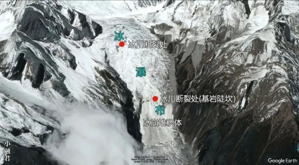
The icefall is 1,100 meters wide, with the glacier’s downward surge resembling an army of thousands rushing forward, as if it would reach the battlefield in just five seconds.
Li Bai, a famous Chinese poet, wrote multiple poems about the Lushan Waterfall, indicating waterfalls’ symbolic aesthetic in Chinese culture. If ancient Chinese had known about the Hailuogou icefall, poets might have shifted their focus from traditional scenic spots to this marvel.
The Mingyong Glacier also features an icefall, split into upper and lower levels. However, it’s not as steep or spectacular as the one at Hailuogou.
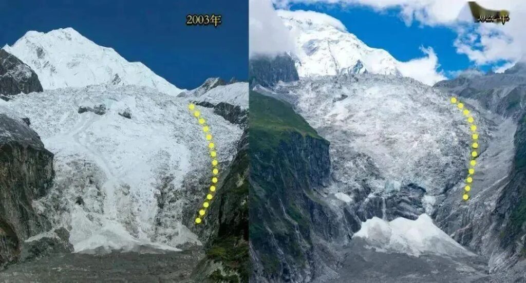
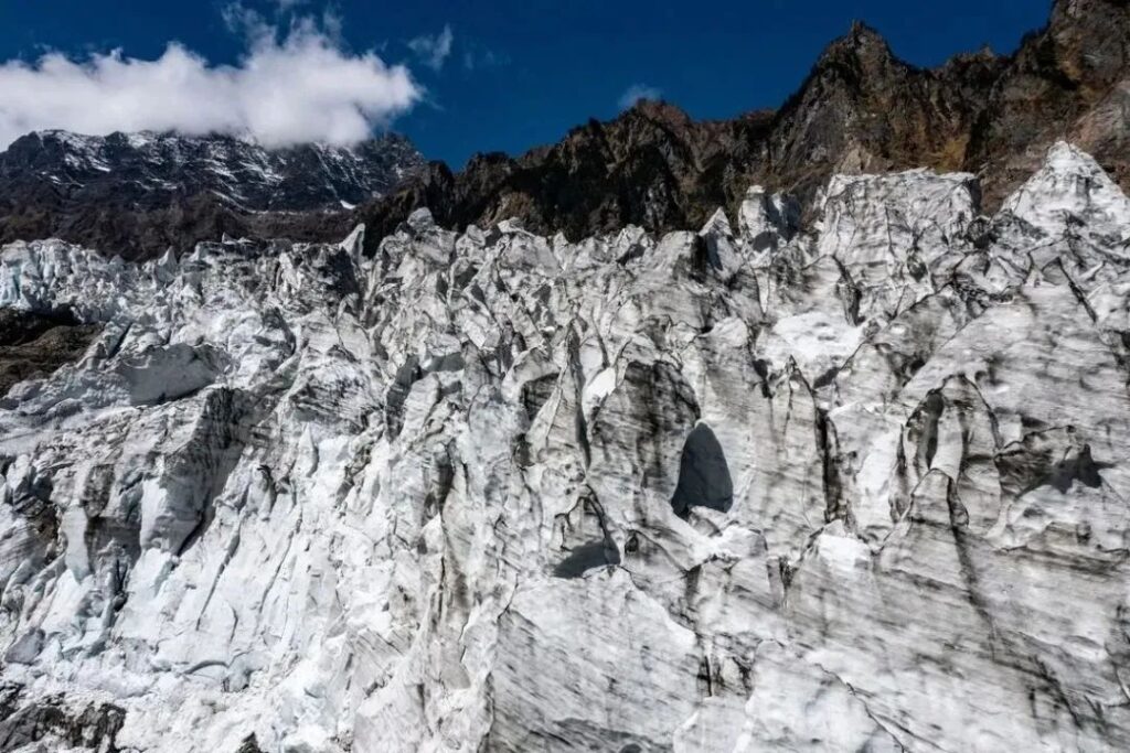
Due to the steep terrain, this area unfortunately becomes a high-risk zone for ice collapses. The ice body continuously experiences ice avalanches. Combined with glacier thinning caused by global warming, the ice mass at the icefall has been steadily decreasing. As a result, over the past 30 years, the gray-black bedrock of the mountain has been increasingly exposed.
Downstream from the icefall, a massive debris fan has formed, created by the impact of falling ice blocks from above.
Despite all this, the glacier continues its relentless journey downstream.
From an aerial view, the icefall plunges over a cliff, ending in a wide, deep valley – the forested area that the glacier yearns to reach.
The rear slope of the firn basin and the icefall section experience hundreds of snow (ice) avalanches daily. Through this process, both the glacier and the debris team grow stronger. The debris, falling alongside the snow and ice, is technically called rockfall.
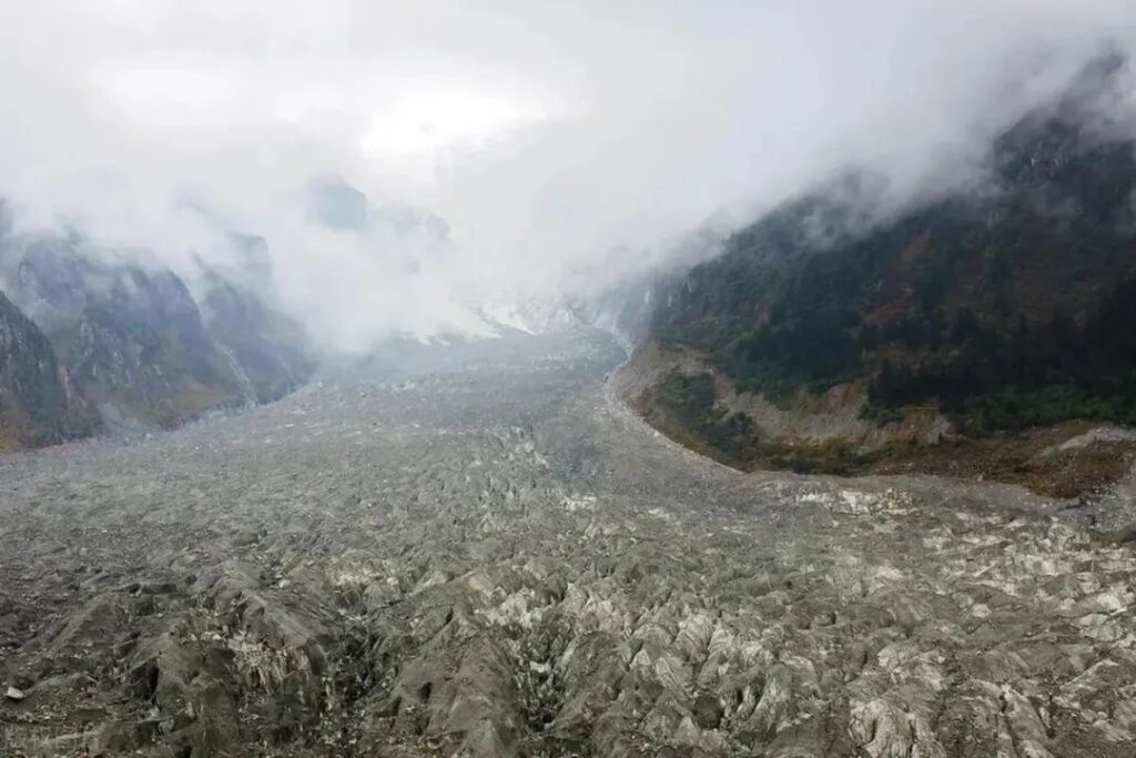
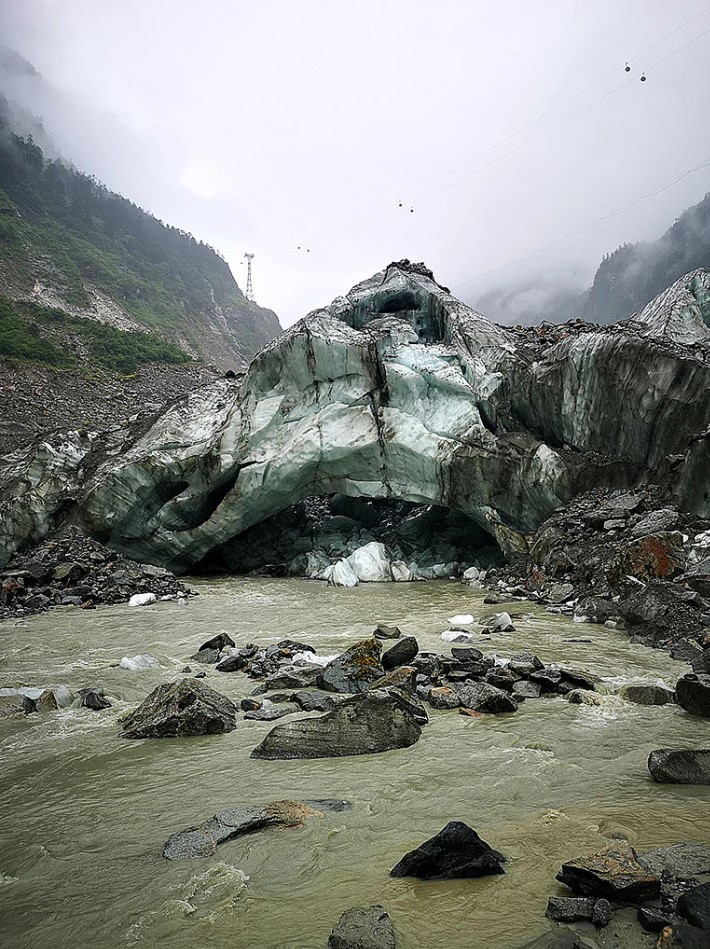
Of course, most of the debris originates from glacial erosion. As the glacier advances, its immense weight causes the rocks beneath to crumble under pressure. These rocks are then carried along with the glacier. As a result, the once pure white glacier descends to the human realm with an earthy scent. The further down it travels, the more surface moraine it accumulates. Eventually, it becomes difficult to distinguish whether it’s a glacier or a mudslide flowing down the mountain.
Fortunately, Li Bai never visited this place. It would have been awkward if he had mistaken the glacier for a mudslide in his poetry.
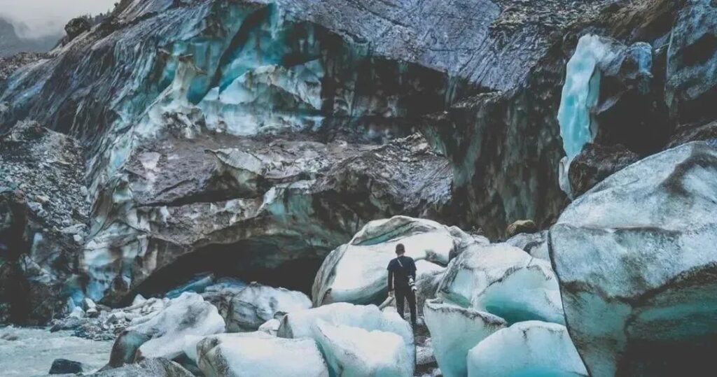
Luckily, beneath the surface, the ice remains unpolluted.
The glaciers in the Hengduan Mountains region are all maritime glaciers, characterized by fast flow rates and a tendency to carry sediment. The Mingyong Glacier faces similar challenges.
Continental glaciers deep in the interior of Tibet don’t face such issues, as they move so slowly that they pose little threat to the rocks along their path.
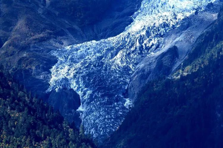
Having explained the glacier’s color, let’s return to the icefall. After passing through the icefall between 4,800 and 3,720 meters above sea level, the glacier transforms, resuming its normal form – the glacier tongue. This tongue stretches 5.7 kilometers long and 0.4-0.7 kilometers wide. While its speed doesn’t match that of the icefall period, it still advances about 100 meters annually.
The glacier tongue winds through the valley in a large curve before descending straight down, flanked by towering peaks and lush greenery.
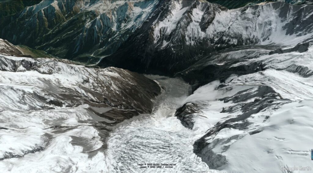
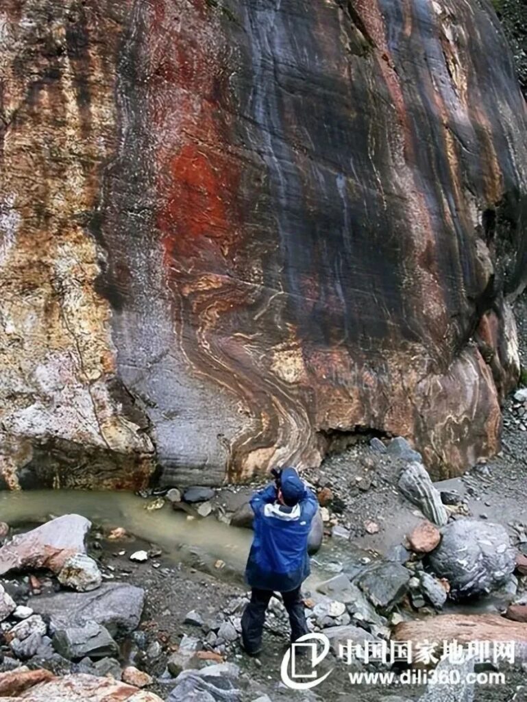
Years of glacial movement have carved a deep gorge in the mountains, technically known as a “U-shaped glacial valley.” As the glacier slides along the valley walls, it polishes them smooth, leaving behind scratches and grooves as evidence of its passage. These glacially polished surfaces are hundreds of meters higher than the current glacier position, indicating that during ancient ice ages, the Hailuogou Glacier once covered the entire valley.
Perhaps aware of its eventual fate to disappear, the glacier seems particularly fond of leaving traces of its presence.
Besides eroding the surface, the glacier also actively transports material. As mentioned earlier, the glacier carries rock debris along its journey. By the time it reaches the tongue section, the glacier has become one with the rock debris, presenting a scarred appearance.
These rocks of various sizes are called “erratics.” In the battle between glacier and erratics, the erratics, initially forced along, end up dominating the glacier’s surface, enacting a “role reversal.”
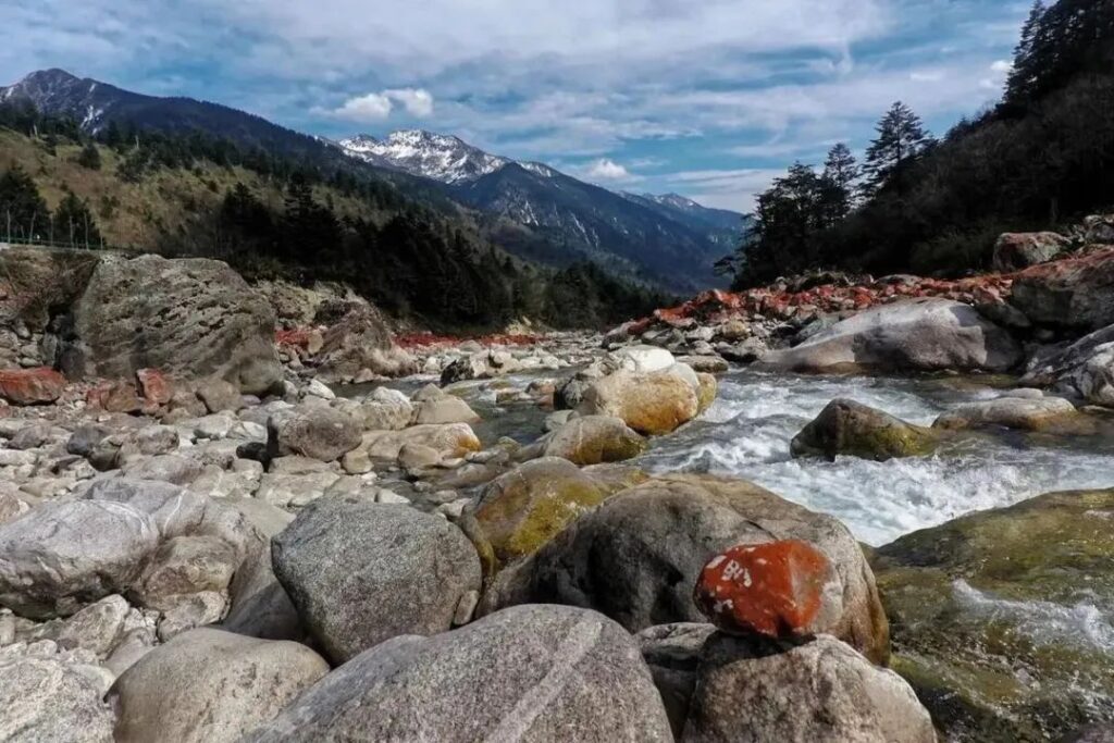
Downstream of the glacier tongue, the glacier loses its ability to transport erratics. These rocks settle and accumulate, forming lateral and terminal moraines.
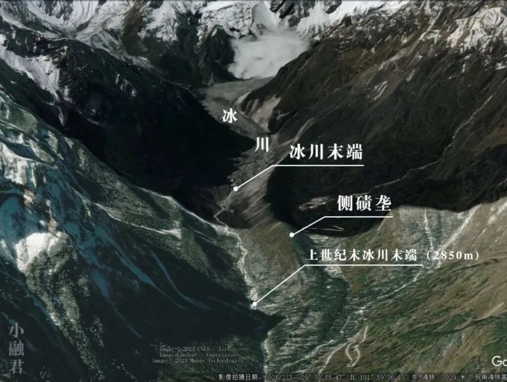
These lateral moraines are high and long, with their ends extending down to 2,850 meters above sea level. As recently as the end of the last century, the glacier still reached this altitude.
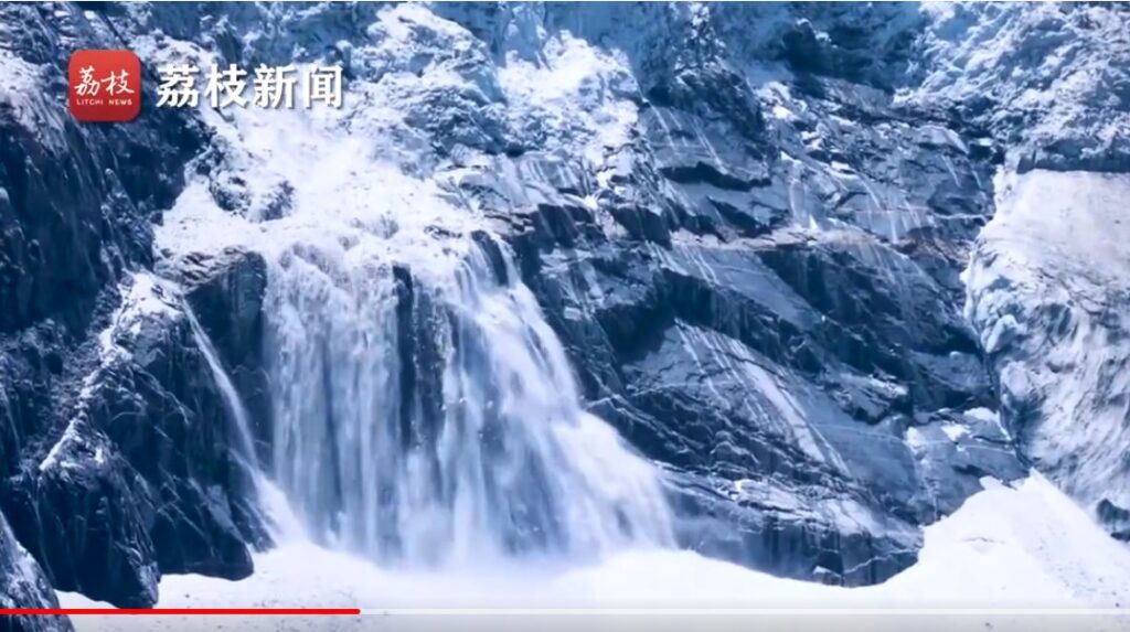
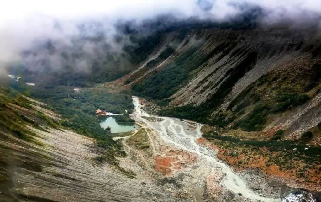
The Hailuogou Glacier begins its journey at the firn basin at 6,750 meters above sea level. After a long 13.1-kilometer journey, it finally reaches its terminus at 2,979 meters. At this point, the Hailuogou Glacier has expended its last bit of energy. The ice body, now only 20-30 meters thick, gradually collapses and breaks apart, transforming into small streams that begin their fantastic voyage down the valley.
Some erratics will also be carried away by the water, joining the Dadu River, then the Yangtze River, and finally becoming grains of sand in the Pacific Ocean.
The rocks that once built mountains ultimately fill the sea – it seems even God’s creation adheres to the virtue of recycling.
As we conclude this narrative, we bid farewell to Hailuogou. Let us hope that the great Hailuogou icefall will no longer fracture, preserving this unparalleled spectacle for generations to come!