Namcha Barwa, hailed as the most beautiful mountain in China, holds a unique and supreme honor. What does it take to earn such a title, and what secrets lie behind its stunning reality?
1.Geography and Culture
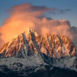
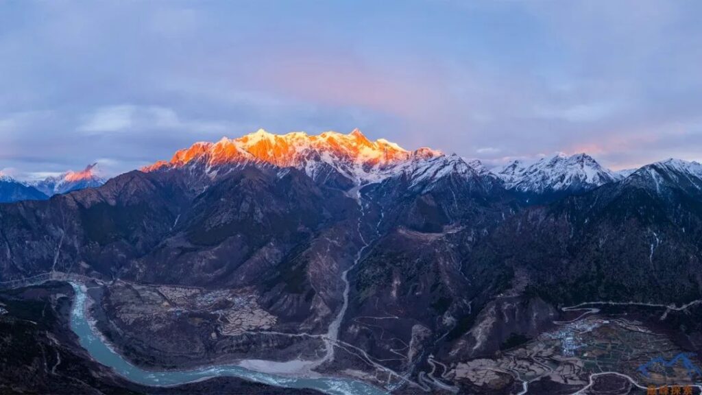
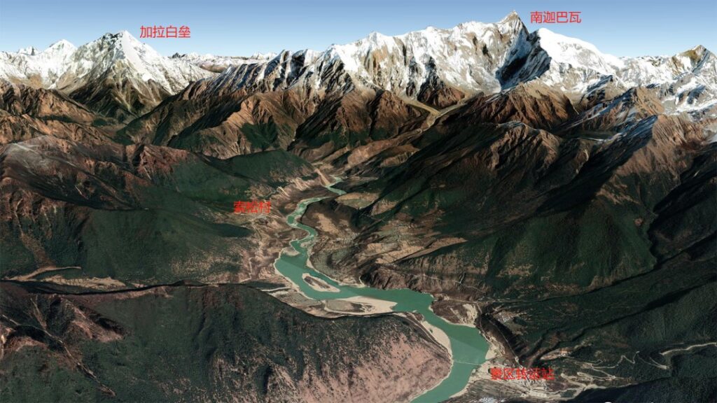
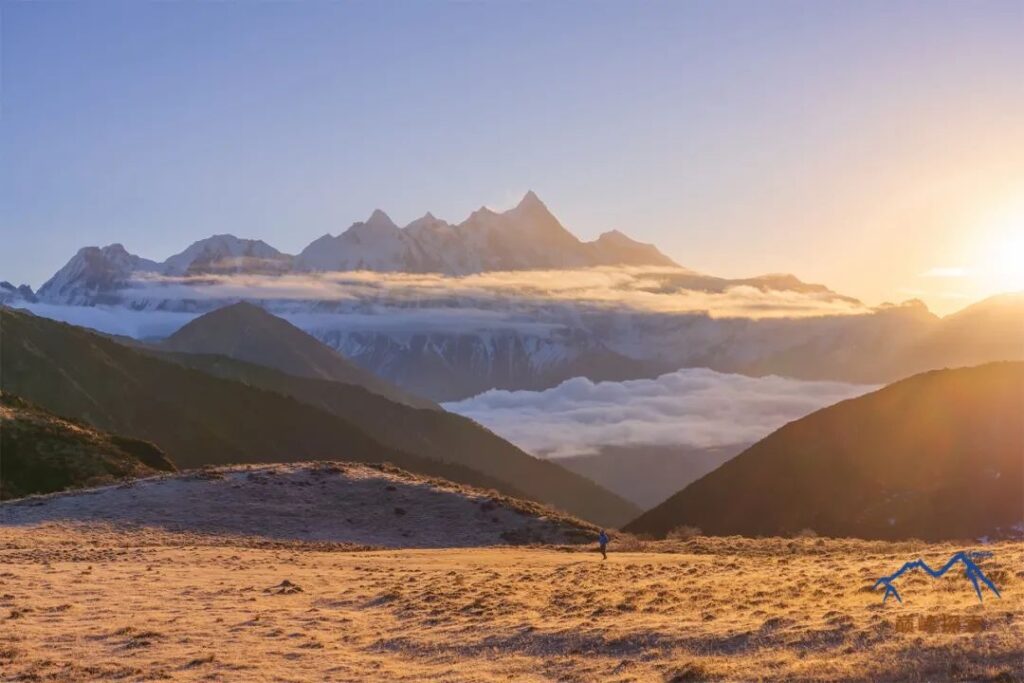
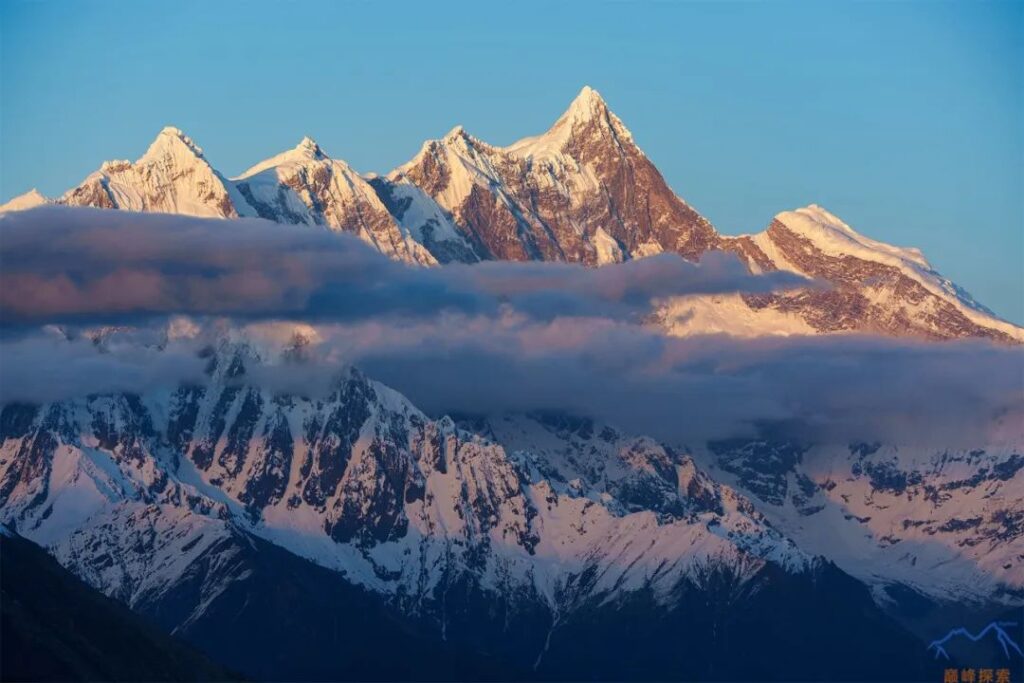
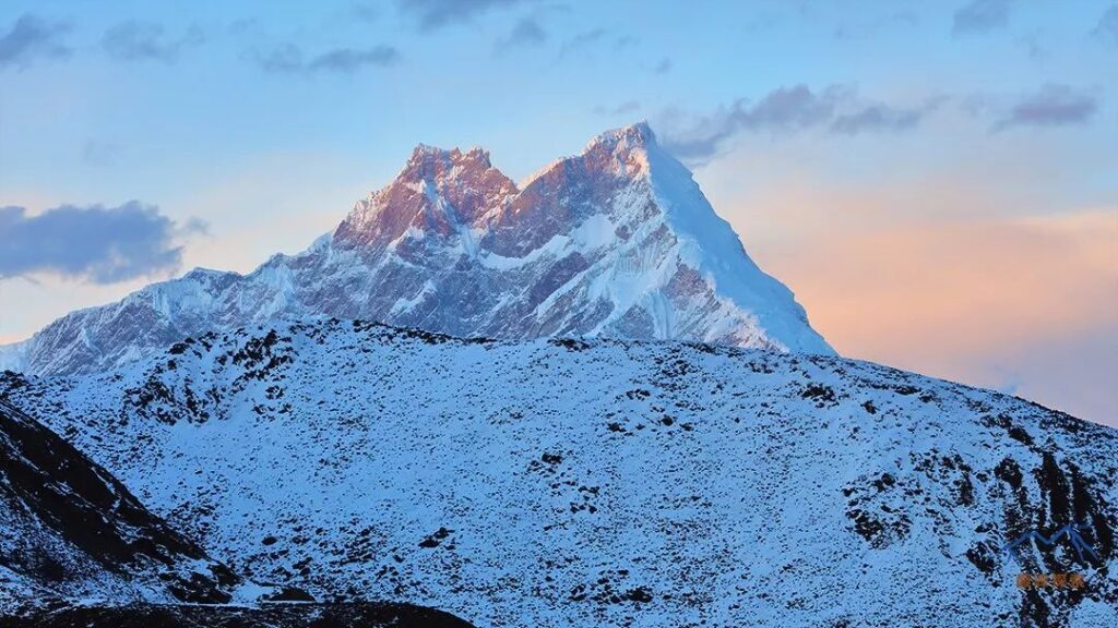
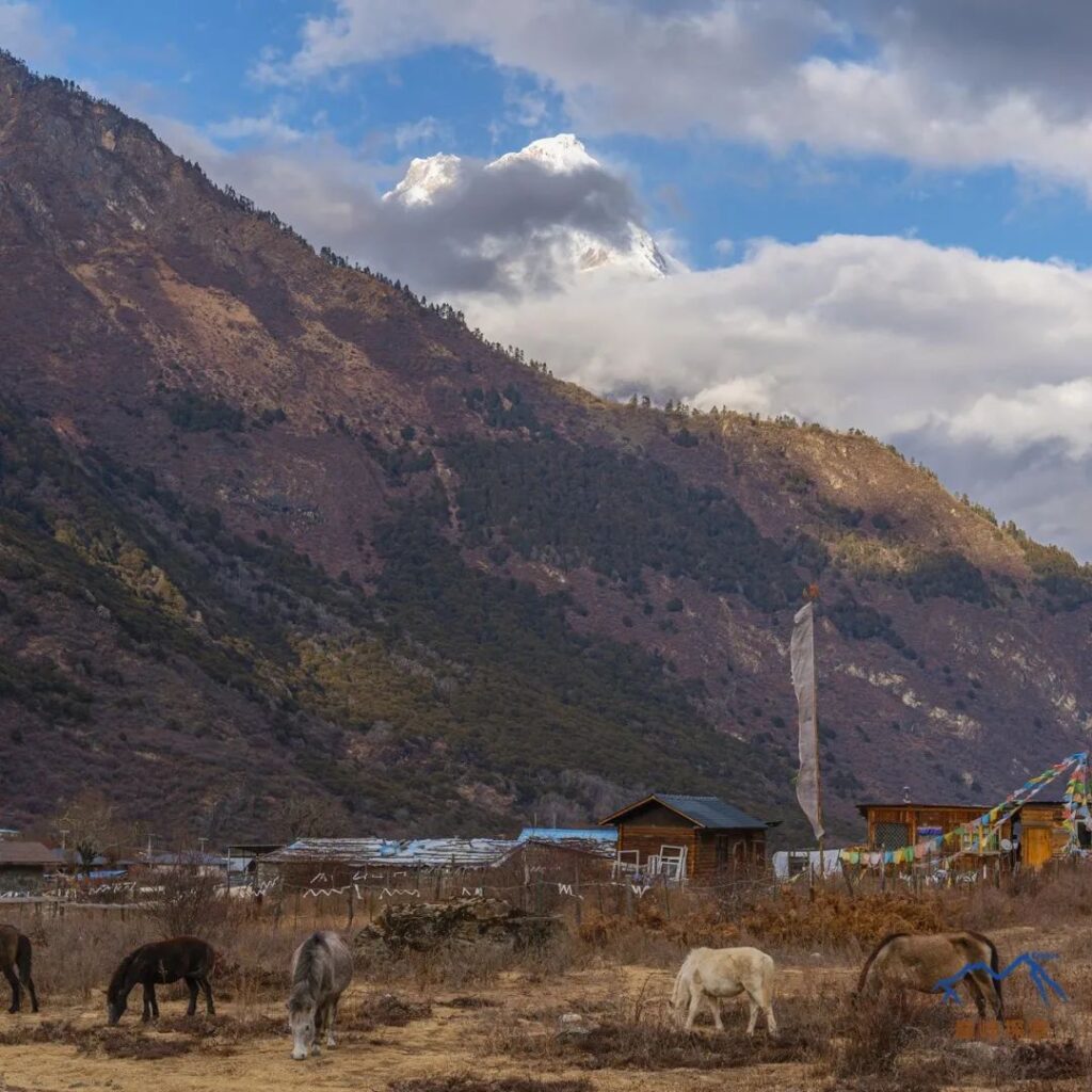
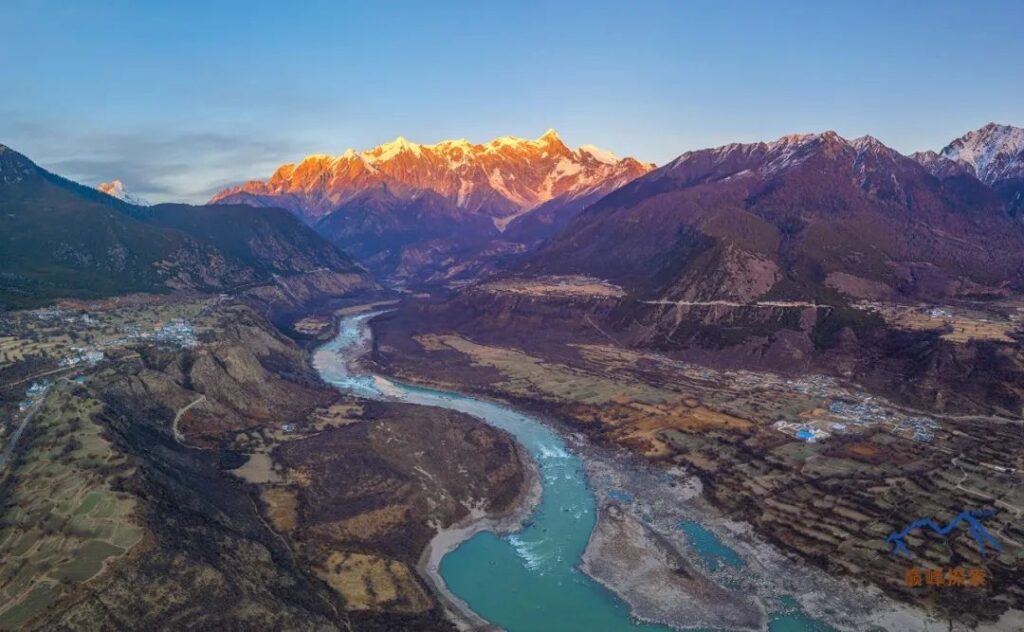
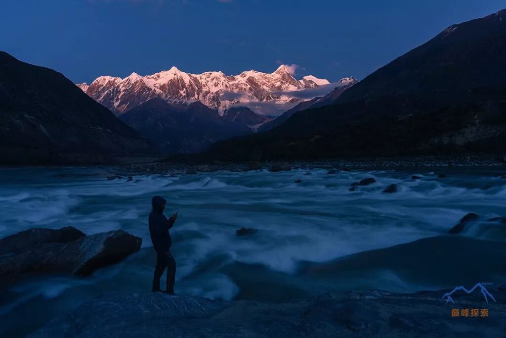
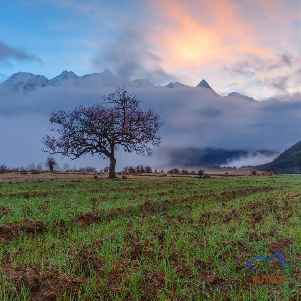
Namcha Barwa, standing at 7,782 meters (25,531 feet), is located at the border of Mainling County and Motuo County in Nyingchi, Tibet. It ranks as the 28th highest mountain in the world and the 12th highest in China. Namcha Barwa is also the highest peak in the eastern section of the Himalayas. Across the river from Namcha Barwa is Gyala Peri, with an elevation of 7,294 meters (23,930 feet), which belongs to the Nyenchen Tanglha Mountains. Although Namcha Barwa is not exceptionally high, its relative height from the nearby Zhibai Village is around 4,800 meters (15,748 feet), while Mount Everest’s relative height from the base camp is only about 3,600 meters (11,811 feet), making Namcha Barwa appear more majestic and imposing.
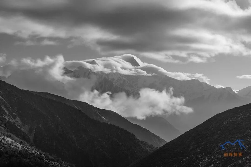
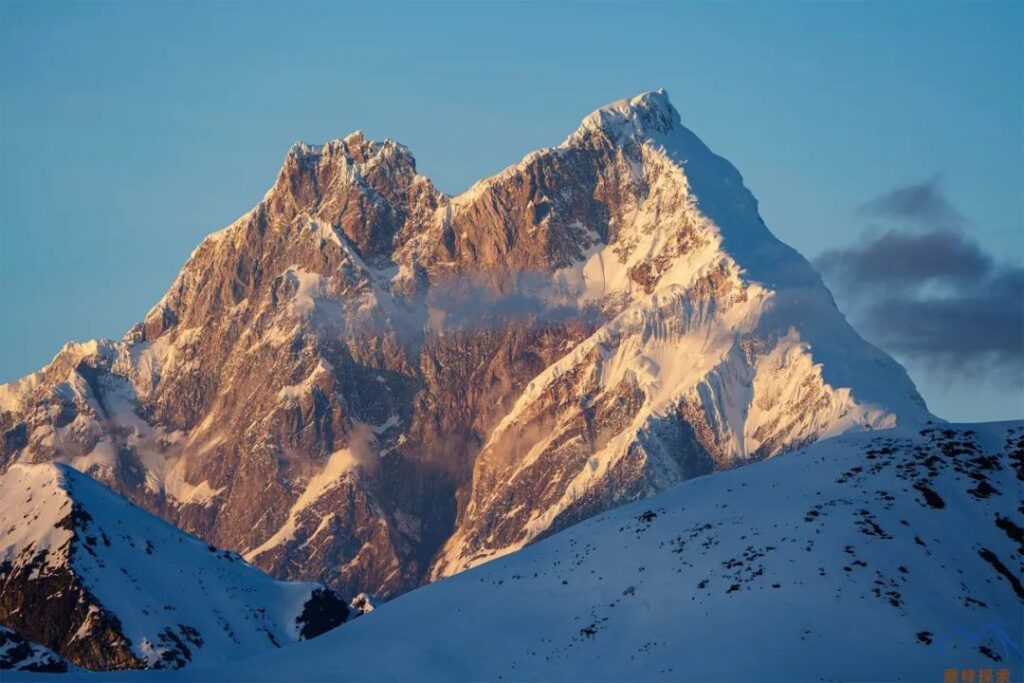
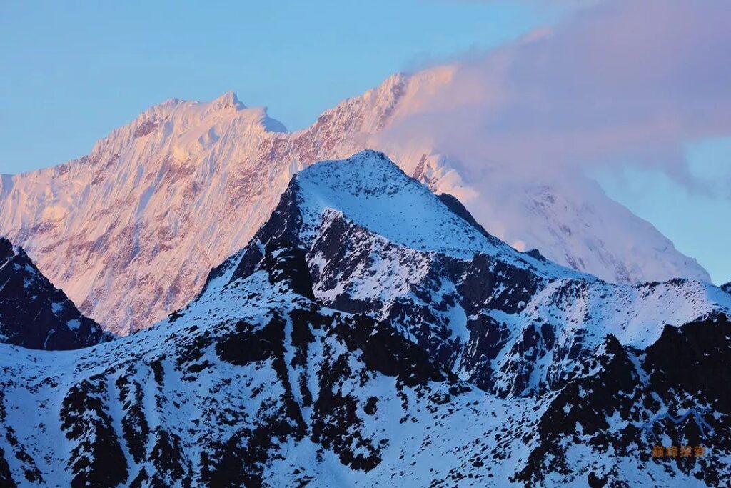
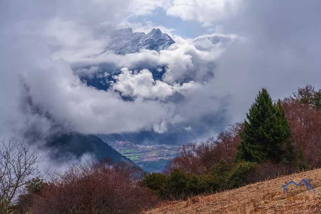
In the Tibetan language, Namcha Barwa has multiple interpretations, one being “burning like lightning and fire” and another being “a long spear piercing straight into the sky.” The massive triangular peak is often shrouded in clouds and mist, rarely revealing itself easily. There is a legend that Namcha Barwa is ashamed to show its face because it cut off the head of its elder brother, Gyala Peri, thus remaining hidden in the clouds and earning the nickname “Shy Girl Peak.”
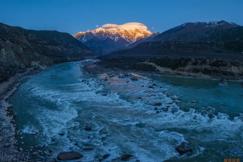
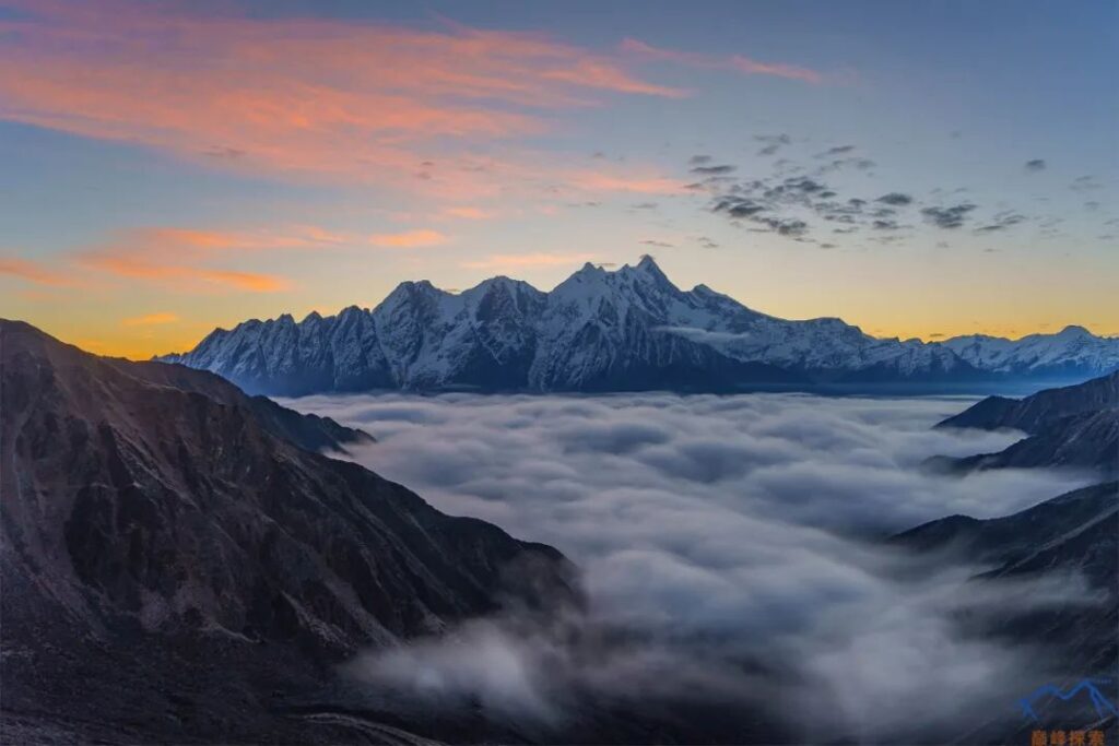
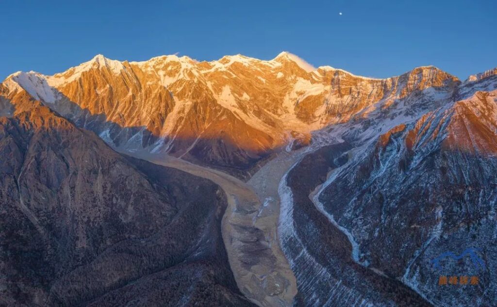
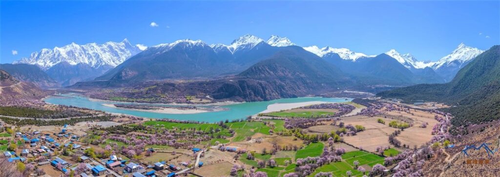
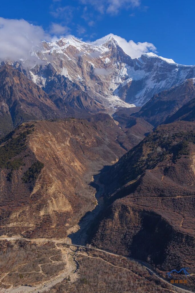
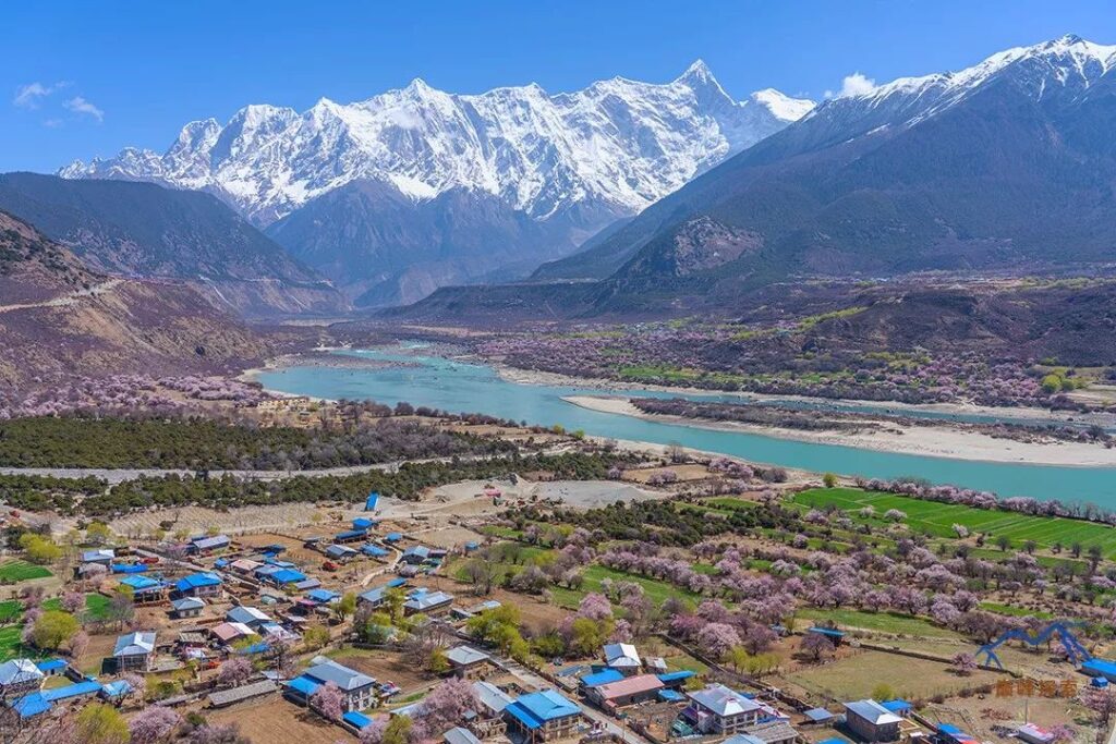
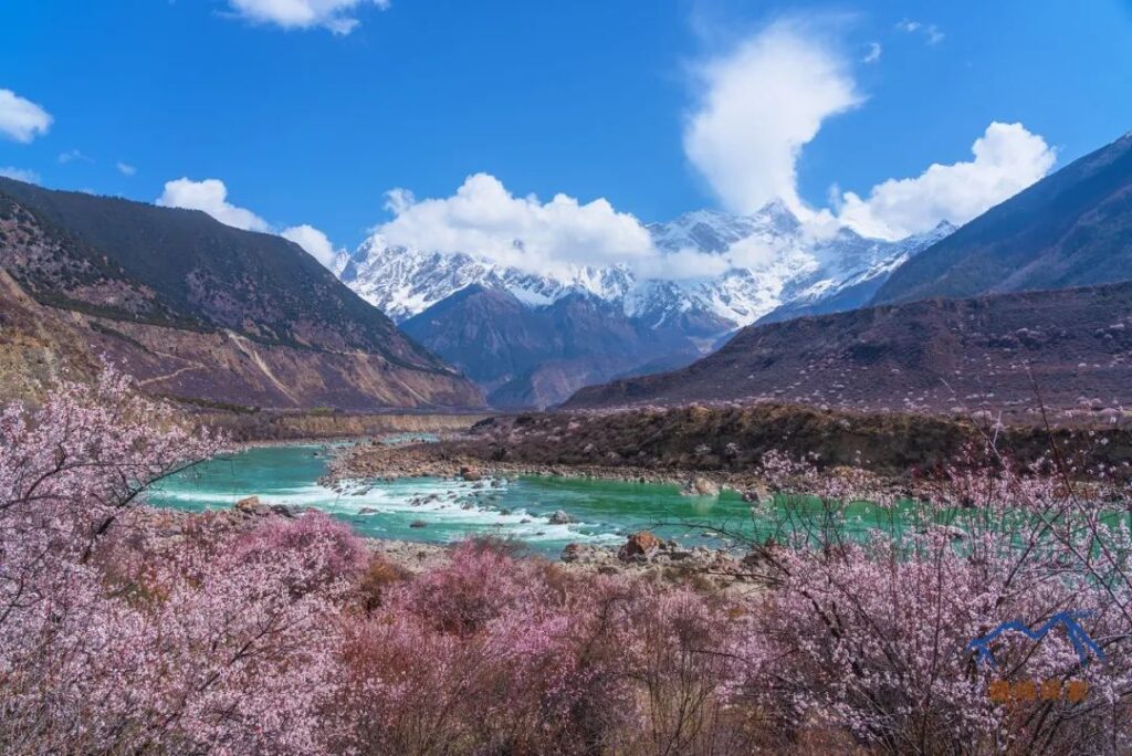
The Yarlung Tsangpo, China’s longest plateau river and one of the world’s highest major rivers, is rich in hydropower potential, second only to the Yangtze River in China. The turbulent Yarlung Tsangpo carves a deep crevice between Namcha Barwa and Gyala Peri, making a spectacular turn towards the Indian Ocean, creating the rare Yarlung Tsangpo Grand Canyon—the deepest and longest canyon in the world, with a maximum depth of 6,000 meters (19,685 feet). The combination of snow-capped peaks and U-shaped canyons is a rare occurrence in the development history of the world’s canyon rivers, making it a natural wonder.
Due to the complex geological structure and intense plate movement in the Yarlung Tsangpo Grand Canyon, the Namcha Barwa region features towering cliffs, frequent earthquakes, and avalanches, making it extremely difficult to climb. As a result, Namcha Barwa remained the highest unclimbed “virgin peak” for a long time until October 30, 1992, when a Sino-Japanese joint mountaineering team successfully reached the summit, marking the only recorded human ascent of Namcha Barwa.
In 2005, China National Geographic selected the “Top Ten Famous Mountains in China,” which included Meili Snow Mountain, Gongga Mountain, Mount Everest, and Mount Kailash. Namcha Barwa topped the list, earning the unique honor of being named the foremost among China’s top ten famous mountains.
2.Route Overview
Please refer to the map below for an overview of the trekking routes and mountain distribution in the Namcha Barwa area. It should be noted that the trekking routes and viewpoints marked on this map only indicate that the geographical locations are accessible but may not be entirely accurate and are for reference only. Outdoor activities carry risks, so please choose excellent teams for a safe journey.
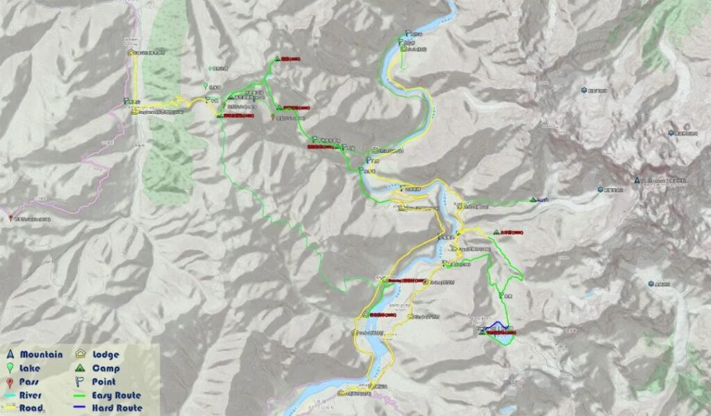
The traditional route for appreciating Namcha Barwa starts from the transportation station in Pai Town, following the eastern side of the Yarlung Tsangpo River to reach Jiala Village. From there, hikers cross the bridge over the river and return to the transportation station along the western side. The main attractions along this route include the western slope scenery of Namcha Barwa and the turbulent Yarlung Tsangpo River. Jiala Village offers a closer view of Gyala Peri. In addition to this main route, there are three branch routes to choose from:
- From Dongbacai Village in Lulang, hikers can ascend the mountain, crossing Dabang La Pass and Zala Pass to enter the Grand Canyon.
- From Zhibai Village or Niding Village, hikers can ascend to the Mountaineering Base Camp and Nara Lake.
- From Songlinkou, hikers can cross the Duoxiong La Pass to reach Motuo County.
Branch route:
- offers breathtaking views of numerous high peaks, including Namcha Barwa, Gyala Peri, Duoxiong La, and Tiba Kangri (Baili Peak) from the mountain passes. Branch route
- provides access to the incredibly beautiful Nara Lake and the legendary Mountaineering Base Camp. Branch route
- allows hikers to experience the dramatic contrast from the vast snow-covered plateau to the tropical rainforest within a short time, making the rich climate variations a highlight of this trekking route. However, this route has been abandoned due to the construction of a road. The northern and eastern slopes of Namcha Barwa are uninhabited areas, mostly used for scientific expeditions and explorations, with barely any accessible trails, making them extremely challenging for ordinary people to reach.
3.On-site Conditions
Seji La
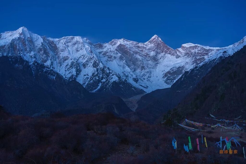
Among the many routes leading into Tibet, the 318 National Highway is a particularly famous one. Before entering Linzhi, travelers need to cross the Seji La Pass. If you are lucky, you can witness the magnificent view of Baili Peak, Gyala Peri, and Namcha Barwa together from this location. It is considered a perfect vantage point, and most people begin their acquaintance with Namcha Barwa from here.
Baifeng Spot
Baifeng Spot is located in the back mountain of Dongbacai Village in Lulang, and it is an ideal place to admire Namcha Barwa. The local authorities originally planned to develop this spot into a tourist attraction, but for unknown reasons, it was not completed. There is a tractor road from the village leading directly to the top of the mountain, accessible by off-road vehicles and motorcycles. If hikers take a vehicle from here to the Grand Canyon, the latter half of the trekking will be mainly downhill, which can significantly reduce the overall trekking intensity. It is worth noting that from December to April of the following year, the mountain is covered with thick snow, making the traverse more challenging. There is a herdsman’s hut at Baifeng Spot that can accommodate four to five people.
Za La Pass
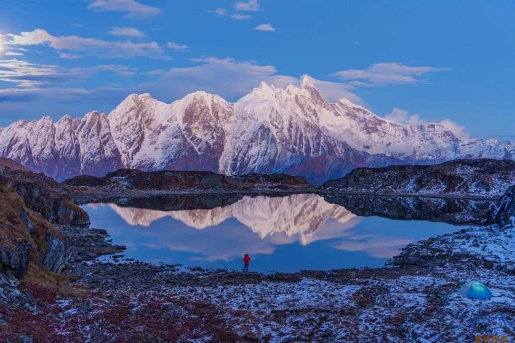
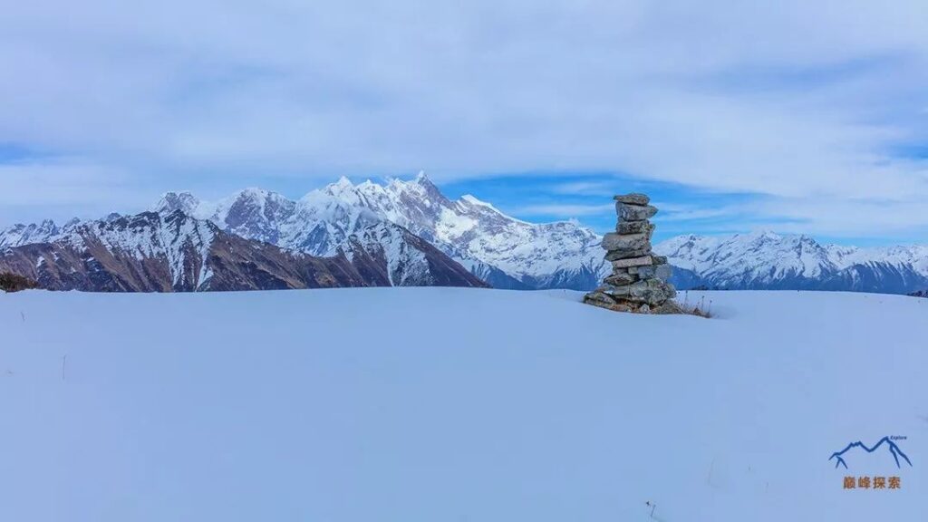
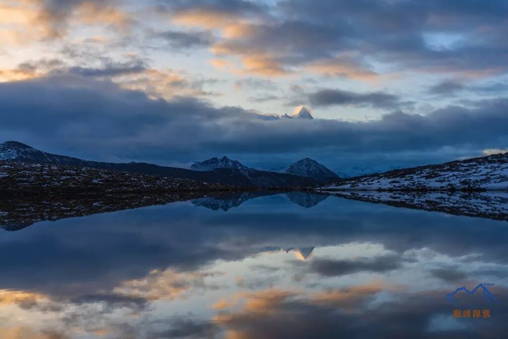
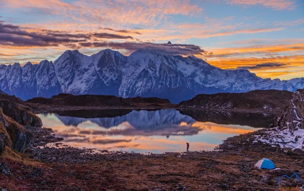
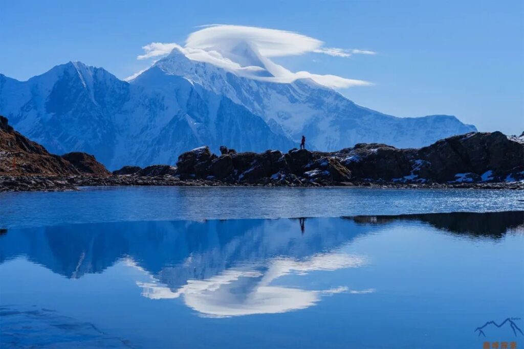
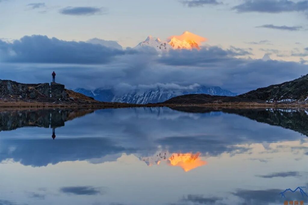
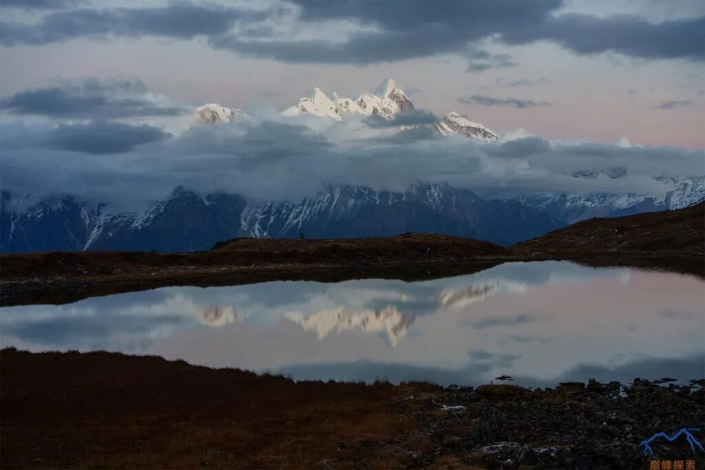
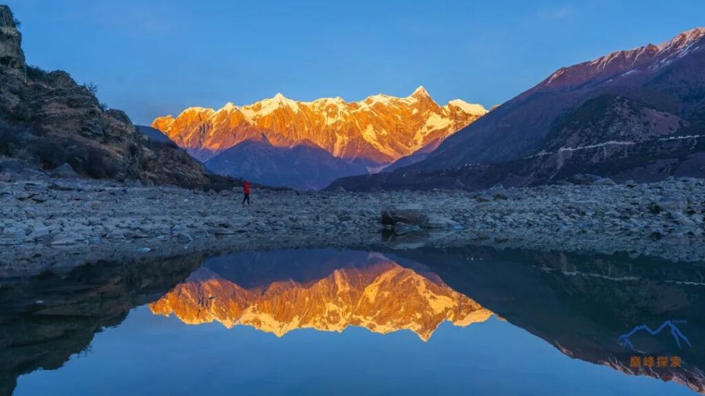
To reach the Grand Canyon from Baifeng Spot, hikers need to first traverse to the left and ascend the mountain, then arrive at Hadi Tang Pasture. Above the pasture, there is a pond where you can capture the reflection of Namcha Barwa, but water is only present during spring and summer. The trail to the Grand Canyon is located below the herdsman’s hut in Hadi Tang Pasture. After another traverse and ascent, hikers will reach Za La Pass. The scenery from this pass is also quite impressive, with nearly all the snow-capped mountains in the Namcha Barwa area visible.
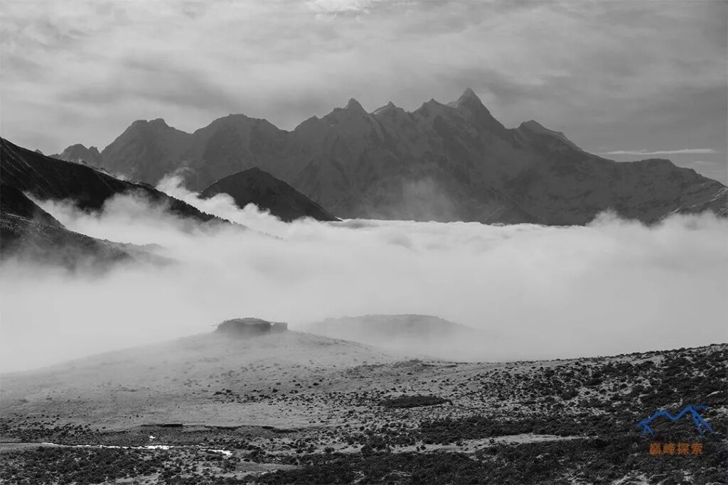
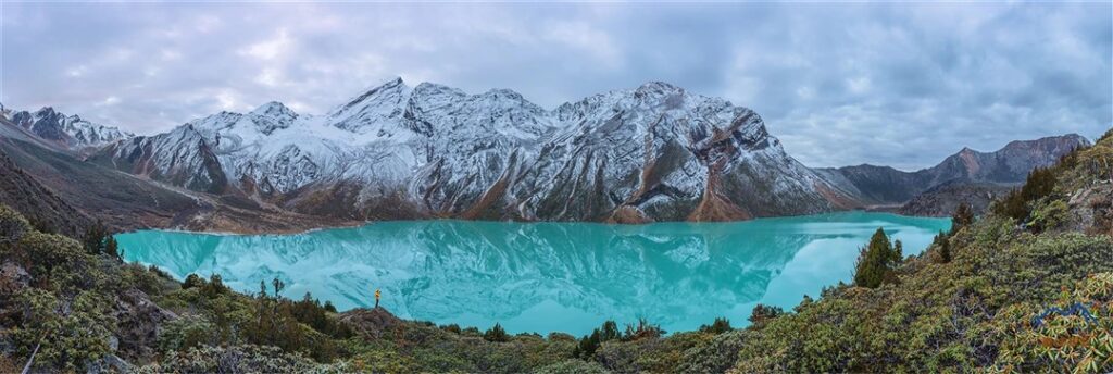
Tso No
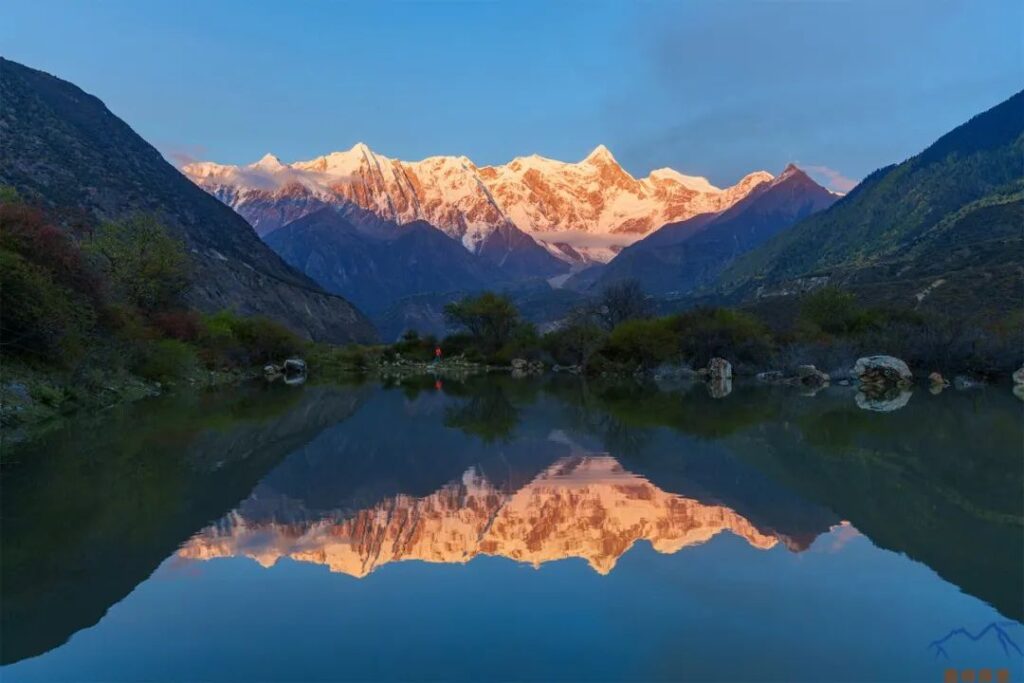
Tso No is located on the northern side of Baifeng Spot and is a place where locals gather caterpillar fungus. The name means “lake shrouded in mist and clouds.” There are five relatively large lakes here, and four of them can be used to capture the reflection of the southern peak. In front of the lakes are the Yarlung Tsangpo Grand Canyon and Namcha Barwa. I consider this one of the best places to photograph Namcha Barwa, equivalent to Lengga Tso for Mount Gongga. What makes it even better is the presence of many highland plants, such as snow lotus, tower-shaped rhododendrons, and yellow rhododendrons.
Tongluo Pasture
To reach the Grand Canyon from Za La Pass, hikers need to walk along the mountain ridge for a while. The trail down the mountain is located near the small hut closest to the valley, and it is crucial not to attempt to traverse down the mountain prematurely. After reaching the small hut (Bangpei Pasture) at the bottom of the valley, there is a clear mountain trail leading all the way to Tongluo Pasture. Due to its high altitude and moderate distance, Tongluo Pasture offers an excellent vantage point to appreciate the Namcha Barwa mountain range.
Jila Village
From Tongluo Pasture to Chibai Village, the route is all downhill, and although the trail is somewhat confusing, it is still discernible. Chibai Village only has a few households, all of which offer food and accommodation. This village is also the only one along the way that is not connected by a road. The fastest way to leave is by boat across the river to reach the road on the opposite bank and then take a vehicle, but currently, the village’s boat was washed away by the river in 2018. From Chibai Village, following the small path along the mountainside in the direction of the Yajiang River will lead to Jila Village.
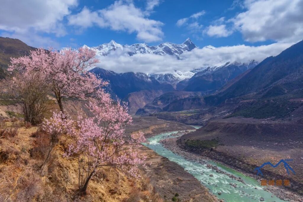
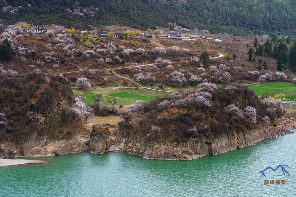
Jila Village is the deepest village in the Grand Canyon, and beyond it lies an uninhabited area. The road connecting Jila Village to Zhibai Village was opened in 2017. Currently, there are not many tourists, and the village remains relatively pristine. At the Tibetan guesthouse, you can taste authentic Tibetan pork and free-range chicken. Jila Temple is quite famous in the local area. It is hidden in the depths of the peach blossoms along the Yarlung Tsangpo River, surrounded by an extremely beautiful environment, a true paradise on earth.
Zhibai Village
Zhibai Village is located at the foot of the main peak of Namcha Barwa and is the village closest to the main peak within the Grand Canyon scenic area. Due to its proximity and the resulting steep viewing angle, along with numerous obstructions, it is difficult to observe the magnificent sight of the connected snow-capped mountains. From the perspective of enjoying the snow-capped mountains, the view from Zhibai Village is not very good.
Tangso
Tangso was originally a pasture hut used by local villagers, situated on a flat area near the glacier on the western wall of the southern peak, but now it is basically abandoned. The trail leading to Tangso is mostly within dense forests, offering few opportunities to see Namcha Barwa. To reach Tangso, hikers need to start from Zhibai Village, and there are roughly two routes. Compared to the trail on the right side that follows the stream, the shaded path on the left side of the mountain is slightly longer but relatively easier to walk, although this is only relative, as many sections of the trail are still difficult to find. The one-way distance from Zhibai Village to Tangso is approximately 6 kilometers, with an elevation drop of about 1,100 meters.
Base Camp
Namcha Barwa was not successfully summited until 1992 by a Sino-Japanese joint mountaineering team, and their base camp was set up at the Jiding Dengga Pasture in Gega Village. The altitude here is around 3,500 meters, directly facing the knife-like western cliff of Namcha Barwa, with an unobstructed view of the main peak, creating a stunning scene. There is a tractor road leading from the foot of the mountain to the base camp, which is accessible by off-road vehicles. Visiting the base camp requires purchasing a separate ticket, which is quite expensive but includes round-trip off-road vehicle transportation and a special meal.
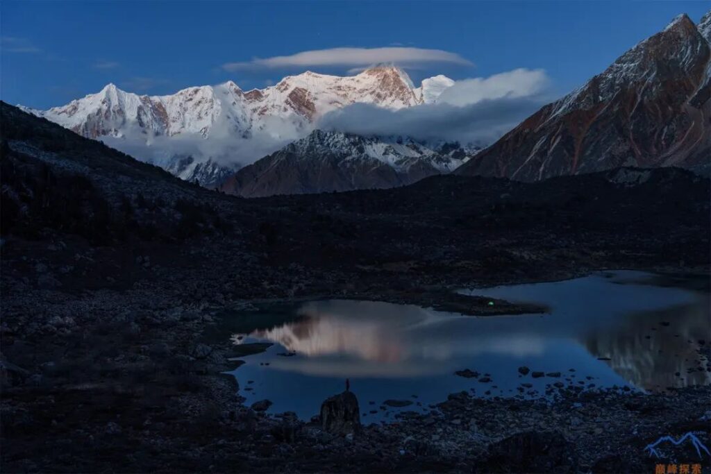
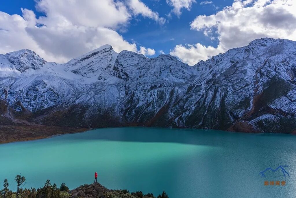
Nala Tso
Nala Tso is a sacred lake for the locals. From the base camp and the Namcha Barwa observation deck, there are stone-stepped trails leading to this place. Walking through the forest, stepping on the thick pine needles, and breathing the air filled with the scent of grass and pine, the originally exhausting hike becomes an enjoyable experience. As fewer and fewer people visit Nala Tso, these two ancient stone-stepped paths have been blocked by many fallen dead trees and are gradually falling into disrepair.
However, Nala Tso is a rare sight. On the map, it appears to be a very large lake, but in spring, it is surprisingly devoid of water and almost dry, which sounds a bit unbelievable. I went three times before I saw Nala Tso filled with water, and its pure colors were intoxicating and unforgettable. The lakeshore of Nala Tso is surrounded by vast expanses of alpine rhododendrons, the scale of which is shocking. If one could witness the blooming flowers, it would be a true blessing in life.
Observation Deck
Between Niding Village and Gega Village, there is a Namcha Barwa observation deck built by the scenic area. One of the two hiking routes to Nala Tso also starts from here. Tourists visiting the scenic area usually admire Namcha Barwa from this spot, so it is generally crowded under normal circumstances.
Tunbai Village
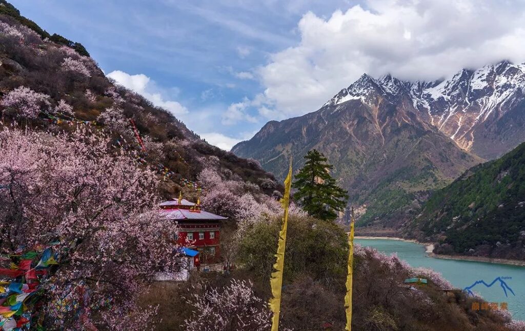
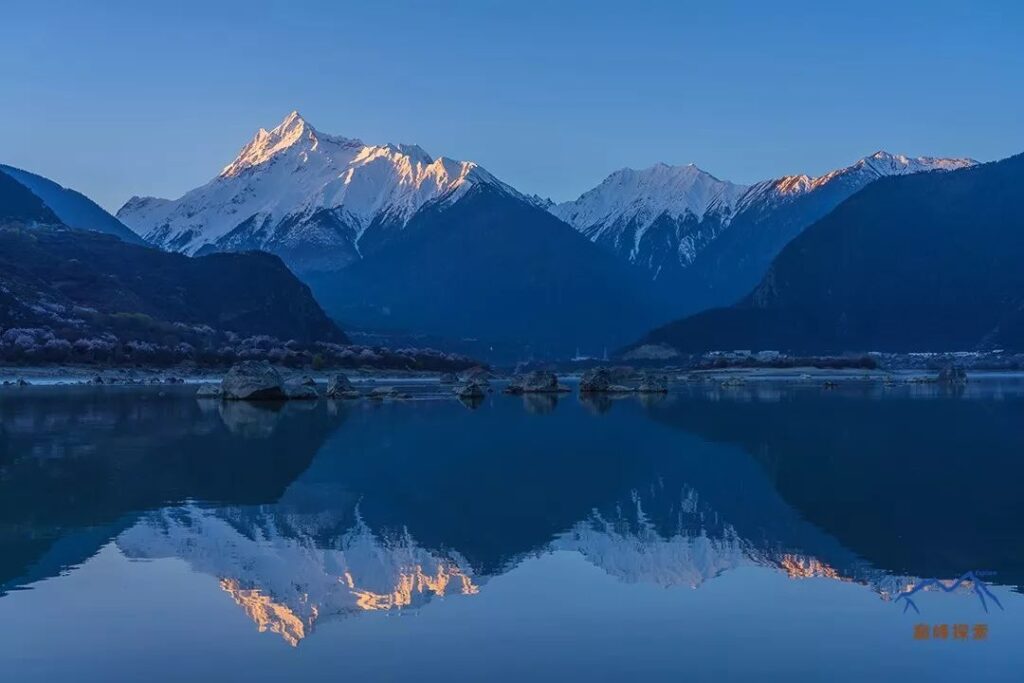
Tunbai Village is situated at a lower elevation, and the subsidiary peak on the right side of Namcha Barwa’s main peak is largely obstructed, so not many tourists stay in Tunbai. However, since the Yarlung Tsangpo River flows gently here and makes a small bend, it creates a perfect angle to enjoy the reflection of Namcha Barwa. Behind Tunbai Village, there is a very small temple called Guru Temple. It is located at a higher elevation with an open view, making it a great place to take panoramic photos of Tunbai Village, Namcha Barwa, and the Yarlung Tsangpo.
Sosum Village
Compared to Tamling Village, Sosum Village offers a better viewing angle: it directly faces Namcha Barwa, has an abundance of peach blossoms, and the Yarlung Tsangpo is right at the foot of the mountain. If you go down to the river, you can admire the towering Namcha Barwa in front of the rolling river. Due to its outstanding viewpoint, Sosum Village attracts many tourists during the peak season, but there is no need to worry as there are numerous hotels and guesthouses in Sosum Village, offering the best accommodation conditions in the entire Grand Canyon.
Devil Head
Devil Head is located between Sosum Village and Tamling Village and is named after its steep terrain. Personally, I think this is the most “straight-on” angle to appreciate Namcha Barwa, similar to the perspective from the base camp. If you don’t go to the base camp, you can make up for it by visiting this place. There may be falling rocks here, so be mindful of safety when staying.
Tamling Village
From Tongluo Pasture, there is also a small forest trail leading to Tamling Village. Of course, the quickest way to reach Tamling Village is to take a bus from the transfer station, passing through Tunbai Village and Sosum Village. From Tamling Village, you can shoot a panoramic view of Namcha Barwa, but the angle is quite oblique, and the mountain has a noticeable tilt, making it difficult to include the Yarlung Tsangpo in the frame. As a result, not many people visit this place for sightseeing.
With this, all the scenic viewpoints along this hiking route have been introduced.
4.Local Specialties
The Grand Canyon has been a scenic area for nearly ten years, and the residents inside have basically become affluent. They either work at the scenic area management office, run family inns, or work as drivers. However, from my interactions with the locals, I feel that they remain simple, kind-hearted, and have a peaceful and natural mindset.
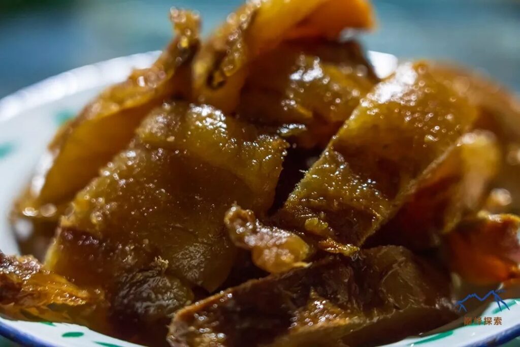
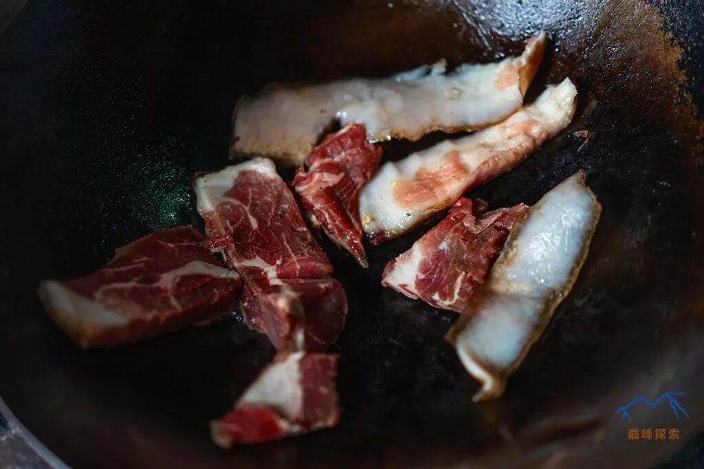
The most authentic delicacies in the Grand Canyon are Tibetan pork and wild mushrooms. The most authentic way to eat Tibetan pork is to air-dry it and then grill it. The taste is quite fragrant, but not necessarily unforgettable. What I can’t forget, however, is a local “crow” mushroom that I once ate in Tamling Village but could never find again. It may be because this type of mushroom has lower economic value, so people are unwilling to pick it. As the number of tourists continues to increase, it is becoming more and more difficult to find these genuine local specialties in the Grand Canyon. If you want to taste them, I recommend staying at a Tibetan guesthouse or visiting less touristy villages.
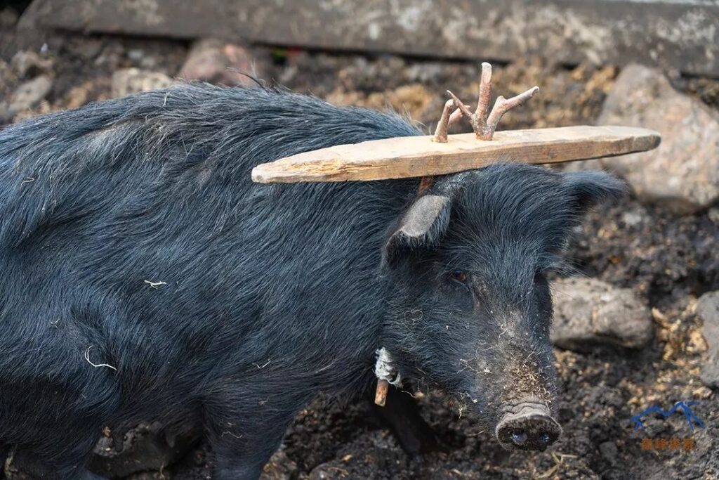
In Jila Village, I encountered an interesting event: there are many Tibetan pigs in this village, but only this one had a unique shape, resembling a criminal wearing a tortoise shell in ancient times. I was very curious, so I took a photo and asked the locals about it. I learned that it had run into the fields and ruined the crops, so the owner clamped its neck and stopped feeding it.
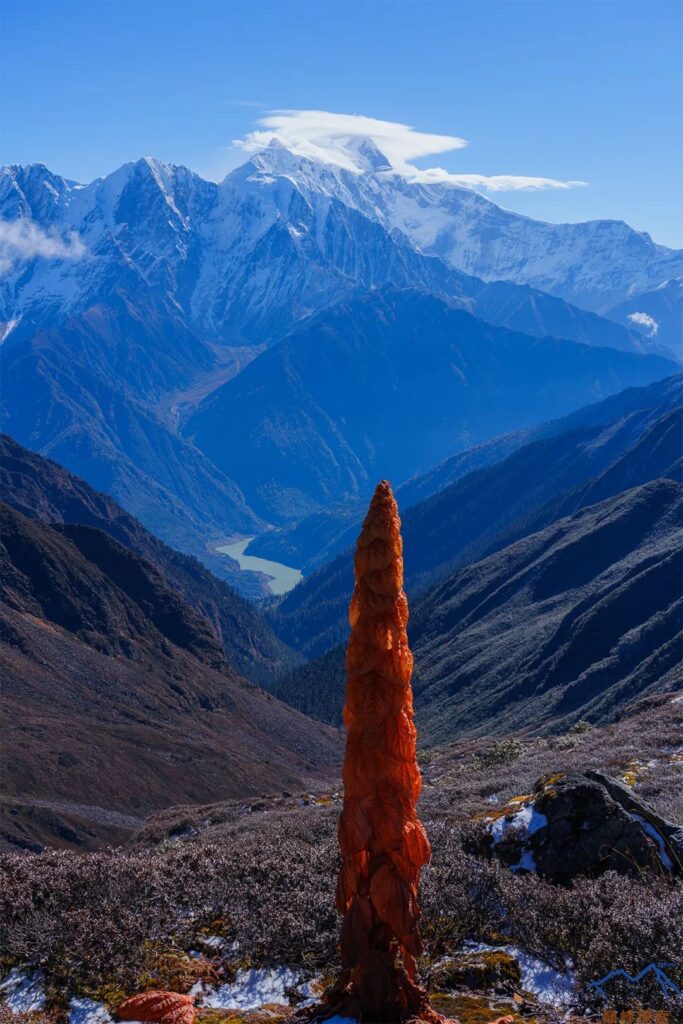
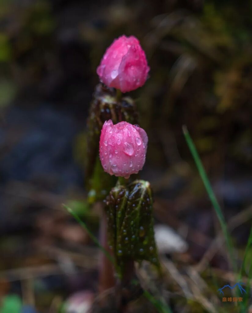
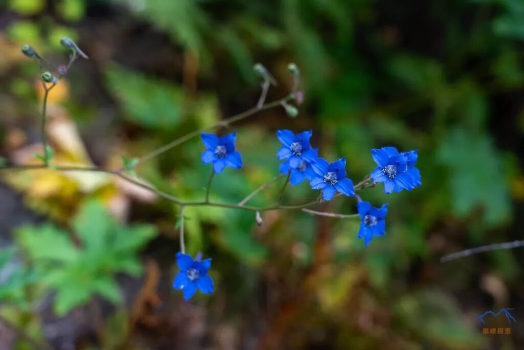
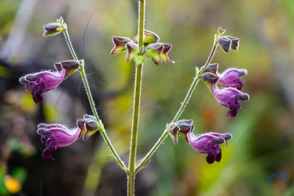
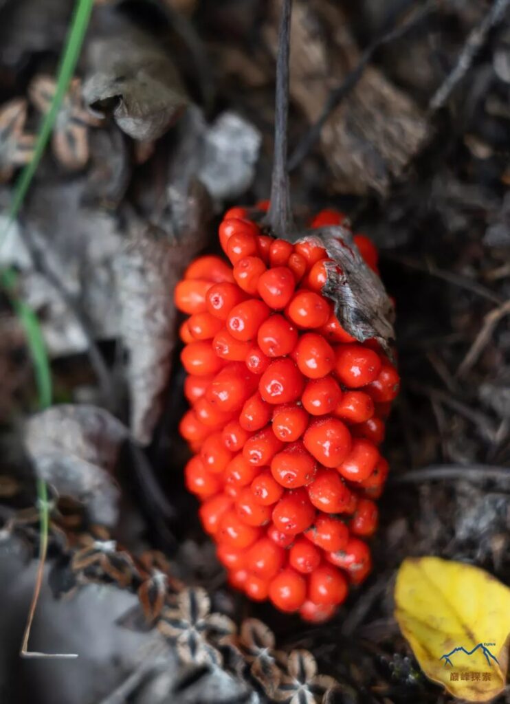
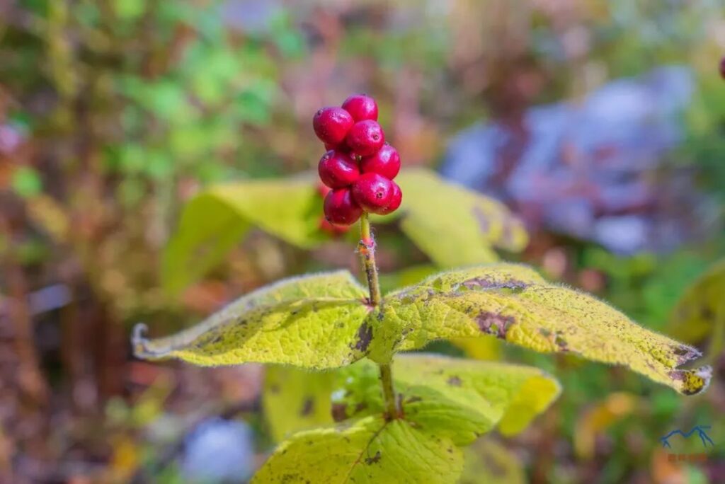
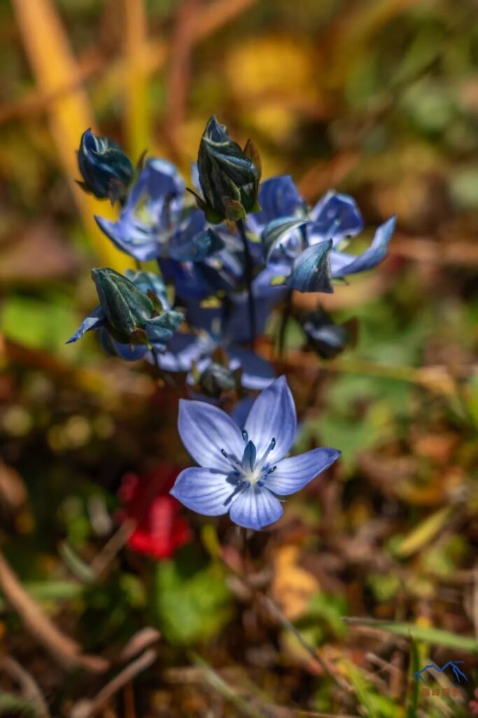
The plant resources in the Grand Canyon are exceptionally rich, enough to write a book dedicated to introducing them, which far exceeds the scope of this article. I can only briefly list some plants with high ornamental value for everyone.
5.Practical Information
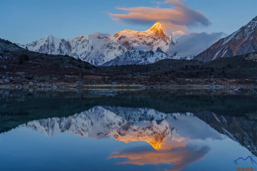
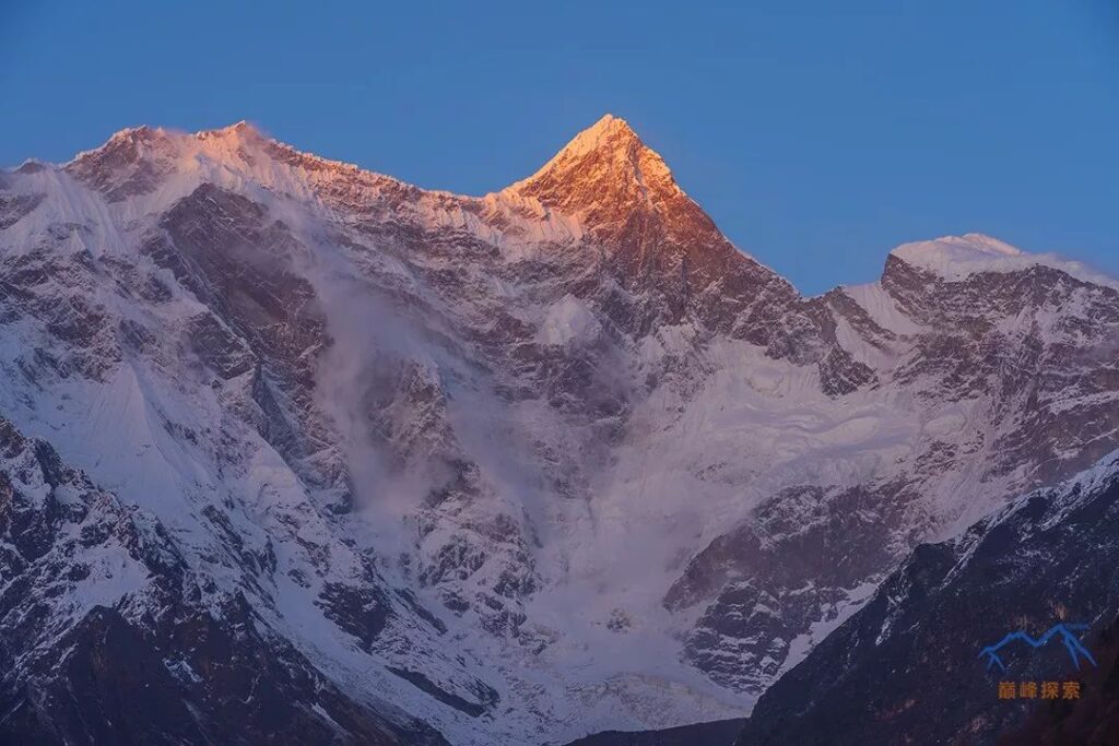
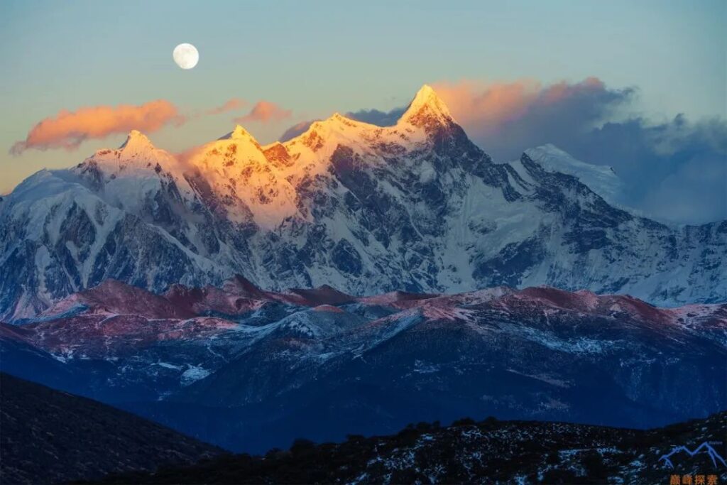
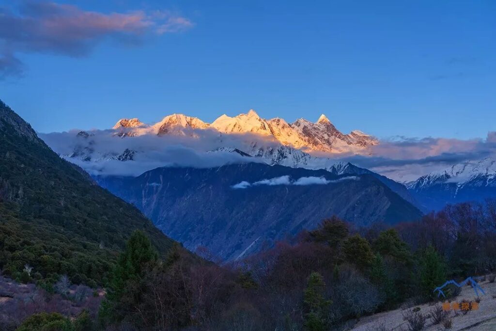
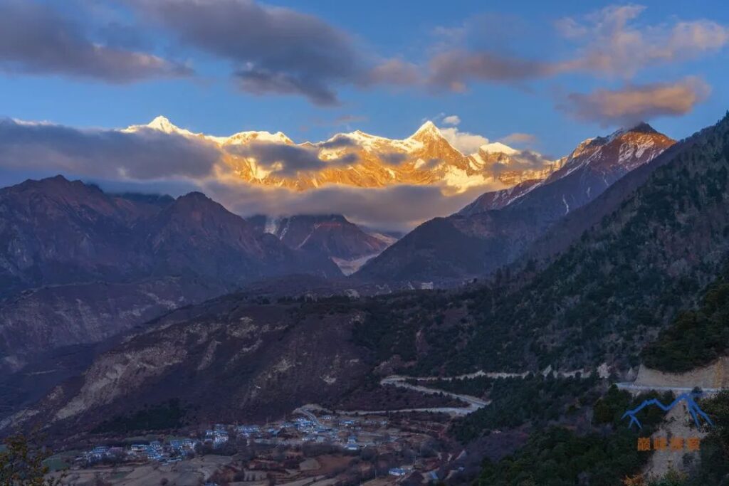
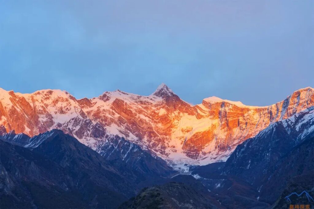
- On this route, only in the evening can you capture the golden mountain illuminated by the sun on the South Peak; in the morning, it is backlit.
- The dirt road from Dongbacai Village to Baifeng Platform is accessible by off-road vehicles or motorcycles.
- The shuttle buses between the transfer station and Linzhi, as well as between the transfer station and Milin (airport), run twice a day in both directions, at 9:00 am and 2:00 pm.
- Along the way, all villages in the Grand Canyon have food and accommodation, with Sosum Village offering excellent conditions.
- There are roads connecting the transfer station to Tamling Village and the transfer station to Jila Village, but no regular buses.
- There are three large bridges spanning the Yarlung Tsangpo River in this area, located at the transfer station, Jila Village, and Tamling Village (this bridge has been washed away and has not been rebuilt yet).
- The boat used for crossing the river from Chibai Village has been washed away by the river, and the village has no plans to purchase a new one, so it is not possible to directly cross the river from the village to reach the road on the opposite bank.
- Baifeng Platform, Zhala Pass, Tongluo Pasture, Sosum Village, and the base camp all offer excellent viewpoints to admire Namcha Barwa.
- If you want to drive to the mountain climbing base camp (Jidingdeng Ga), you need to contact the village head of Gega Village in advance.
- A tunnel has been constructed at Duoxiong La Pass, and the road from Pai Town to Motuo is about to be completed. At that time, hiking to Motuo will become history.
- Along the way, most areas have good China Telecom and China Mobile signal coverage, with occasional signal loss in some valleys and turns.
- The best time to visit this route is from April to May and from October to November each year.
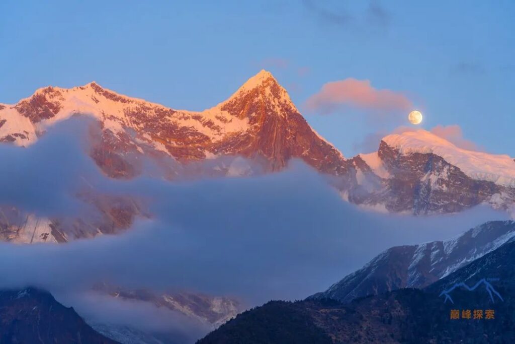
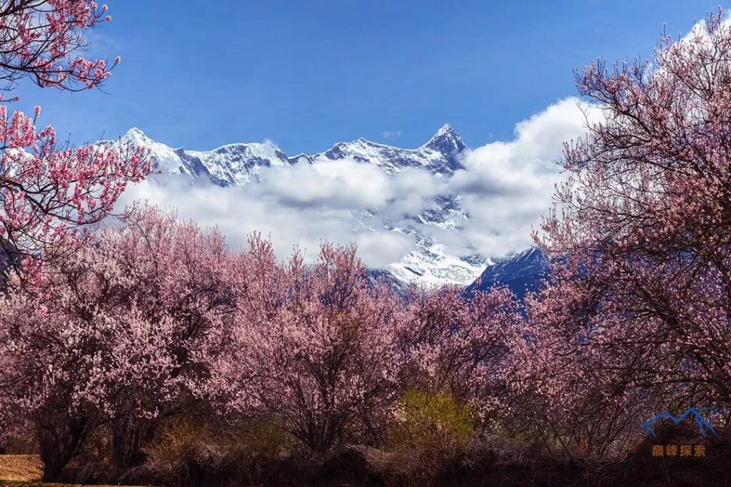
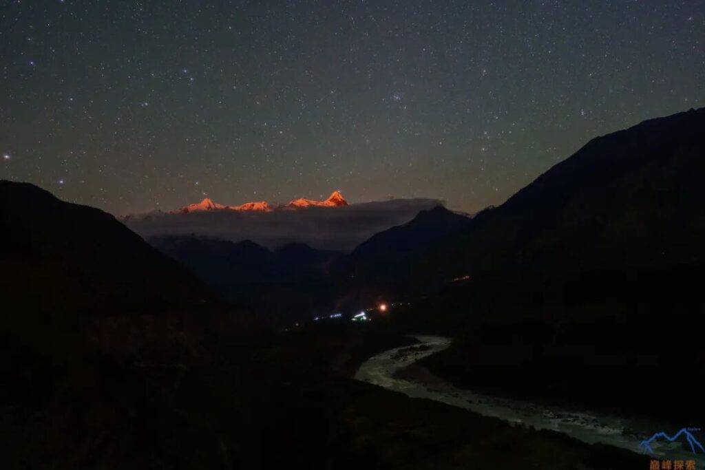
- The biggest obstacle to viewing Namcha Barwa is the weather. It is recommended to visit the Grand Canyon in April to see the peach blossoms, go to Nara Lake in June to see the rhododendrons, and visit Sosum Village and Baifeng Platform in November to see the golden mountain illuminated by the sun.
6.Overall Evaluation
Namcha Barwa bears the title of China’s most beautiful mountain, followed by Gongga, Mount Everest, Meili, and Kailash. However, if you ask me how many points more beautiful Namcha Barwa is compared to other peaks, it is difficult to answer, as beauty, unlike the height of a mountain, cannot be quantified. Nevertheless, the beauty of Namcha Barwa is quite unique in several aspects:
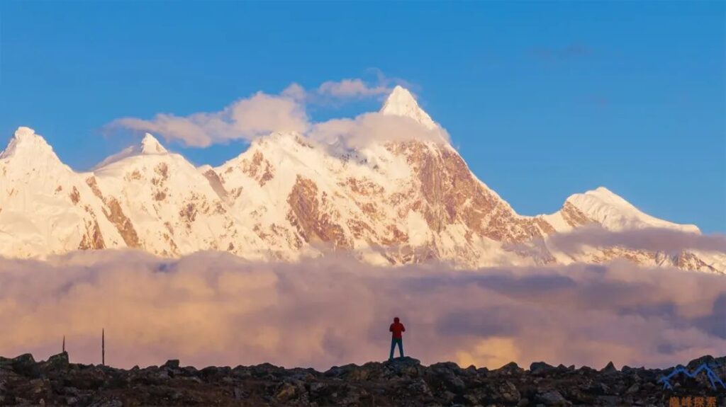
- Firstly, Namcha Barwa has a huge relative height. Even in Sosum Village, without going down to the river, there is a huge elevation difference of 4,600 meters, making the South Peak appear exceptionally tall and majestic.
- Secondly, Namcha Barwa has a unique mountain shape. The main peak protrudes like a spearhead above the surrounding peaks, and the vertical rock walls inspire awe.
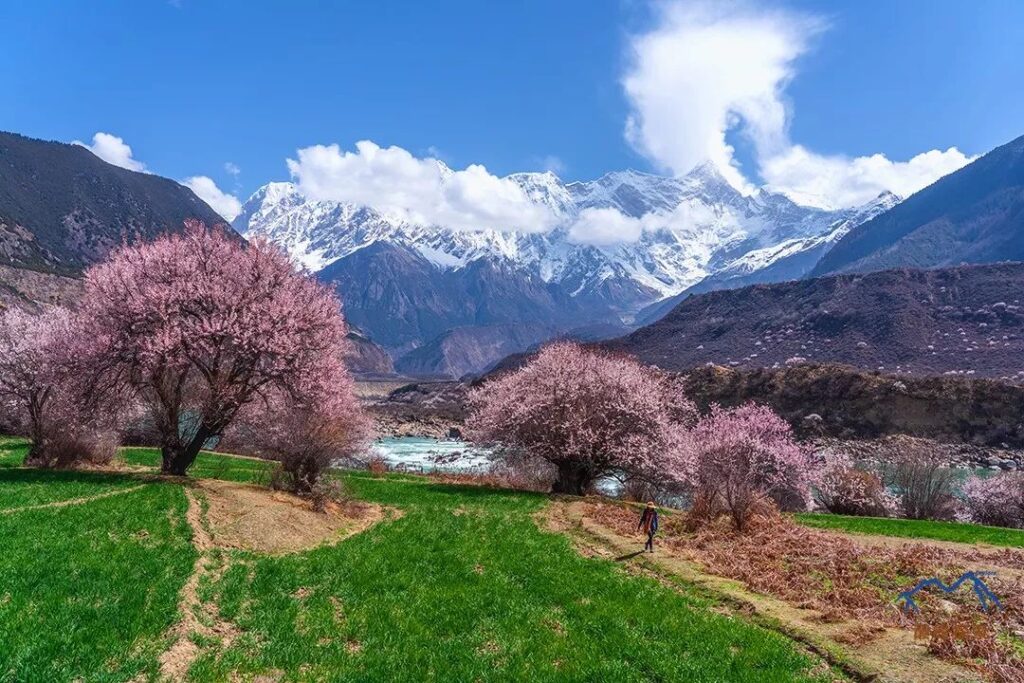
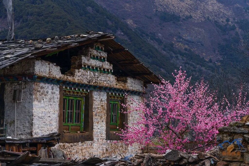
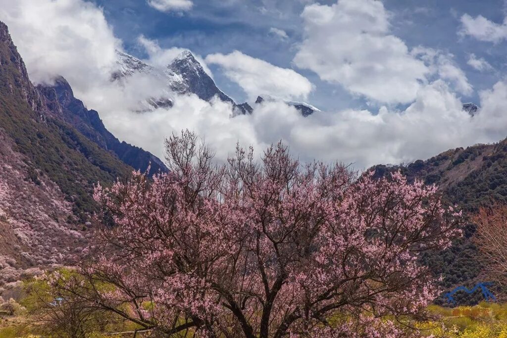
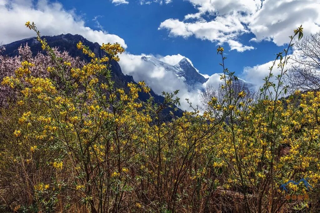
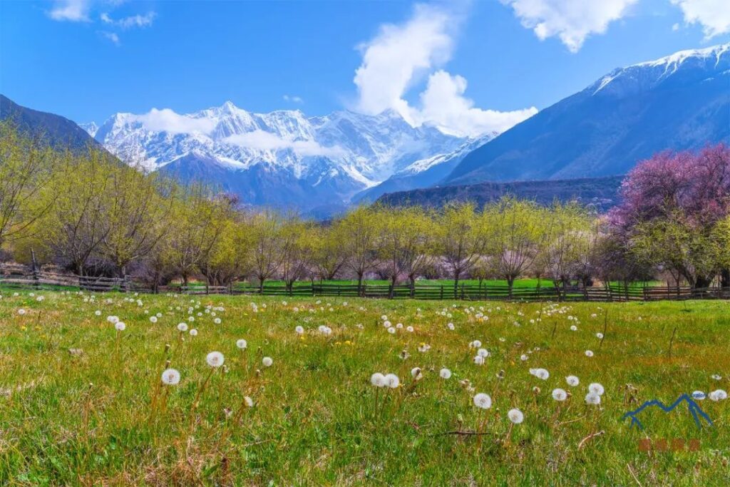
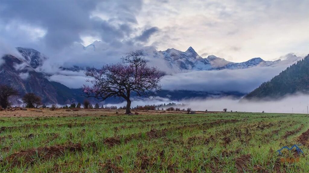
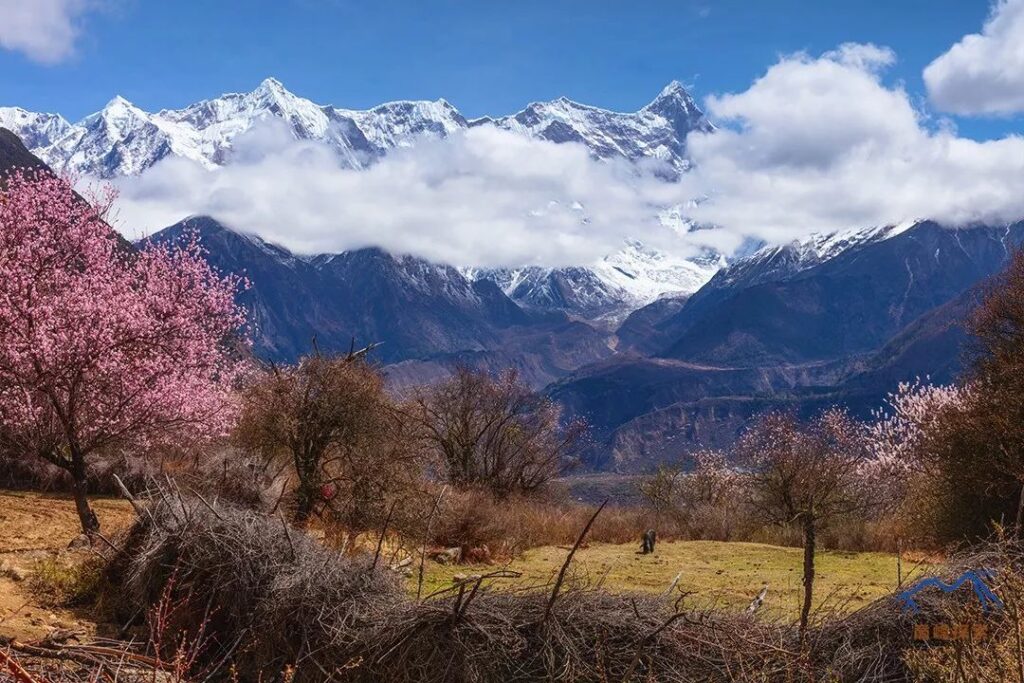
- Thirdly, Namcha Barwa is surrounded by a rich and three-dimensional landscape. In the Grand Canyon, the river rushes, and the valley is filled with green barley, tender yellow willows, and pink peach blossoms. Slightly higher up, there are dense forests with towering ancient trees and colorful rhododendrons. Above the mountain pass, there is white snow. A single route can allow people to experience all four seasons, from spring and summer to autumn and winter, in a short period of time.
- Fourthly, Namcha Barwa has many unobstructed viewpoints, both high and low, far and near, fully showcasing the beauty of the South Peak.
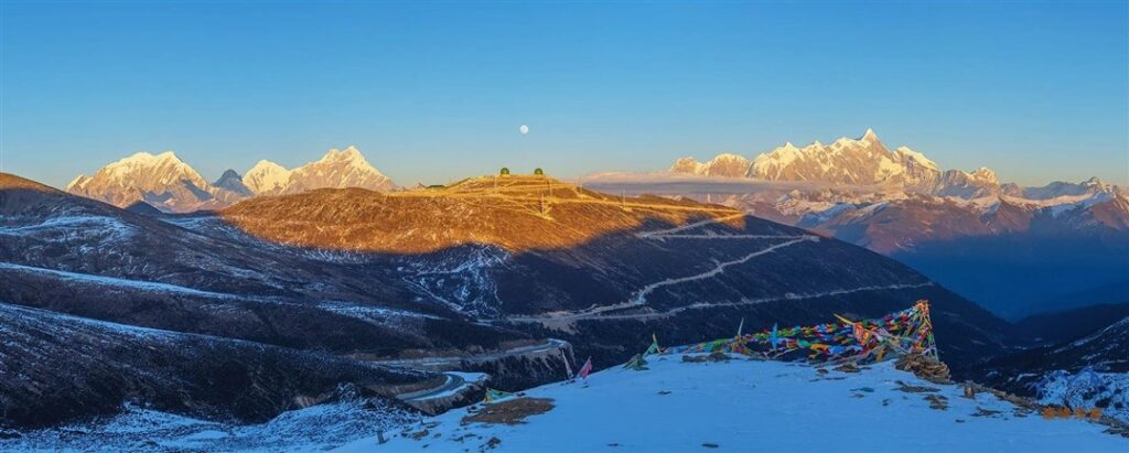
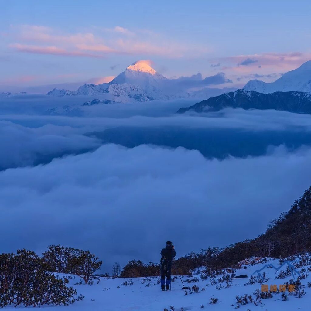
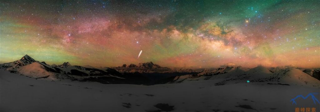
- Fifthly, Namcha Barwa has unpredictable weather. It is a very luxurious thing to witness the golden mountain illuminated by the sun. The more difficult it is to obtain something, the more people desire it.
- Sixthly, Namcha Barwa has many hidden realms. Its northern, eastern, and southern slopes are all uninhabited areas. Due to the steep slopes and dense forests, it is difficult for ordinary people to reach, and even scientific expeditions have only explored a small area of the Grand Canyon.
The uniqueness of Namcha Barwa is inseparable from the Yarlung Tsangpo Grand Canyon. The Himalayan orogeny and the continuous erosion by the Yarlung Tsangpo River have jointly created this rare Grand Canyon, while also opening a huge gap in the mountain barrier of the Qinghai-Tibet Plateau, allowing the warm and humid airflow from the Indian Ocean to penetrate deep into the plateau, turning the southeastern part of the Qinghai-Tibet Plateau into a green world.
The handsome snow mountains, deep river valleys, colorful holy lakes, and warm and humid airflow together create the most magnificent, beautiful, and mysterious natural scenery in the eastern Himalayas. Namcha Barwa, a snow mountain that can be described as perfect.
Route Rating (out of 5 stars):
- Scenery Index: ★★★★★
- Weather Index: ★☆
- Intensity Index: ★★☆
- Risk Index: ★★★